The tripod is 1,280 grams. The 150–500mm telephoto is 1,720. The 14–24mm is 650, the 24–120mm is 630, the camera body 615. That comes to 4,895 grams — just under eleven pounds — and that's before a single battery, filter, or item of actual backpacking gear goes into the pack. I carried all of it seventy miles from Crescent Meadow to the summit of Mount Whitney and down the other side.
I never weighed the full pack — I didn't want to know what the number would do to my morale.
In this post I'll cover the High Sierra Trail from a photographer's standpoint: the seven-day itinerary we walked, how the permits really work, what each of those lenses was actually worth on trail, and an honest account of the hardest day — which, to my own surprise, was not the day we climbed the tallest mountain in the lower 48.
The route and the numbers
The High Sierra Trail starts at Crescent Meadow in Sequoia National Park, crosses the Great Western Divide at Kaweah Gap, drops all the way down to the Kern River, climbs back out to meet the John Muir Trail, and finishes over the top of Mount Whitney. You exit at Whitney Portal, which is why nearly everyone walks it west to east.
The sign at the trailhead lays the whole thing out:
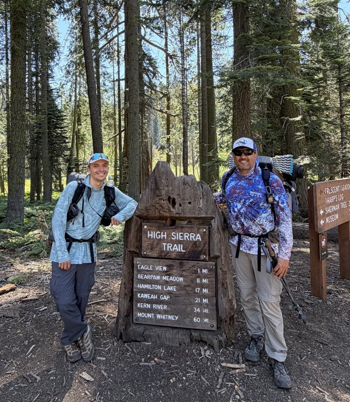
Eagle View 1, Bearpaw Meadow 11, Hamilton Lake 17, Kaweah Gap 21, Kern River 34, Mount Whitney 60. Add the descent to Whitney Portal and my GPS track came out at 70.6 miles with about 16,300 feet of gain and 14,600 feet of loss, running from 6,670 feet at the trailhead to 14,485 at the top.
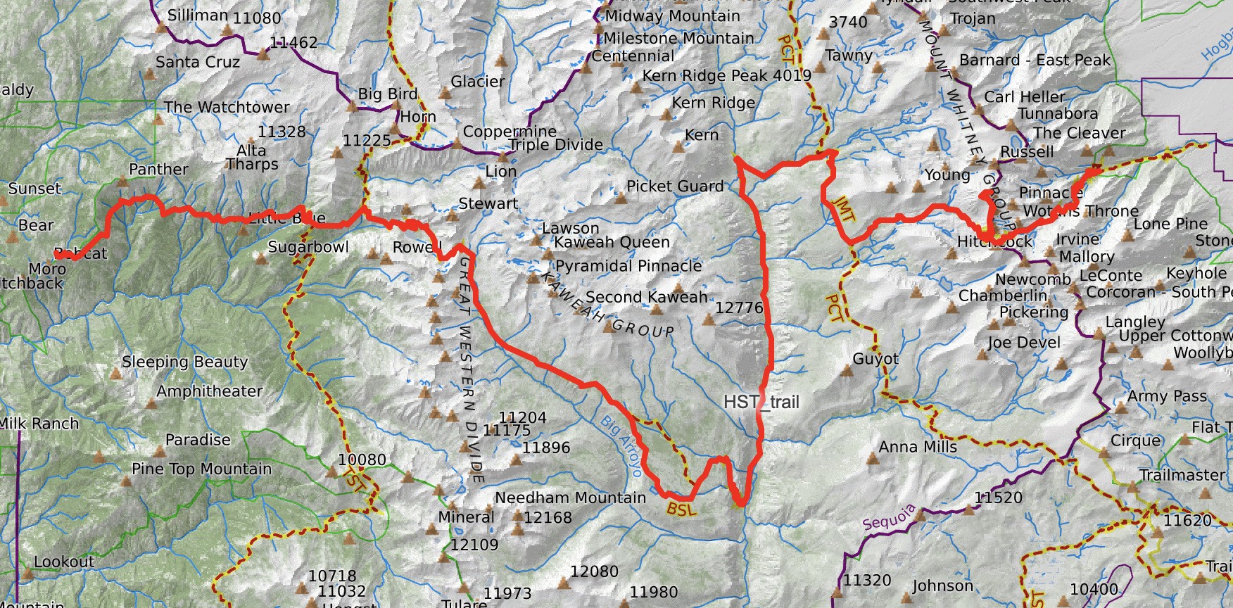
The totals don't really show you the shape of the trail — the elevation profile does a much better job:
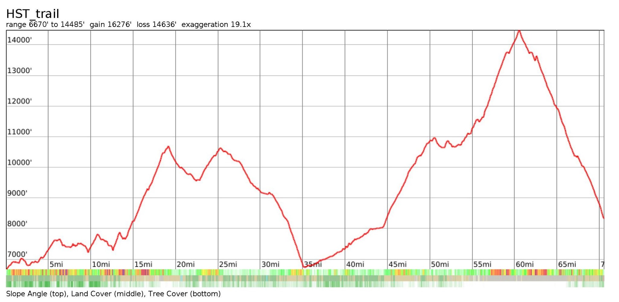
The trench at mile 35 is the Kern River, and everything to the right of it is one long 7,800-foot climb to the summit. Most people plan this trail around Kaweah Gap, because it looks like the crux on the map — but the part that actually hurt was the low stretch around that trench. More on that below.
Our itinerary, July 14–20, 2026:
| Day | Camp | Notes |
|---|---|---|
| 1 | Buck Creek | Just below Bearpaw Meadow. First bear. |
| 2 | Hamilton Lakes | The trail's showpiece, and its most-photographed water. |
| 3 | Big Arroyo | Over Kaweah Gap. Best night of the trip. |
| 4 | Moraine Lake | Across the Chagoopa Plateau. |
| 5 | Kern River junction | The hardest day. Heat, burn scar, rattlesnakes. |
| 6 | Guitar Lake | The staging camp for Whitney. |
| 7 | Whitney Portal | 1am start, summit at dawn, out. |
Seven days is a comfortable pace for this trail — well, as comfortable as it gets with this much climbing.
Permits: brutal online, easy in person
We booked our permits online six months in advance, because the Crescent Meadow quota is small and it goes fast. That's the standard advice, and as far as the online system goes, it's true: reserving an HST start date is genuinely hard.
But here's what nobody tells you. When we showed up at the ranger station to pick up our reserved permits, there were fourteen more permits sitting unclaimed, available to anyone who walked in and asked — in peak season. If I'd spent six months refreshing recreation.gov thinking that was the only way in, I would have been pretty upset standing at that counter.
So if you're flexible on dates, and especially if you can start midweek rather than on a weekend, walking into the ranger station is a real strategy for the High Sierra Trail.
The other thing worth knowing: an HST permit gets you over Mount Whitney without the Whitney lottery. You enter the Whitney Zone from the west on a Sequoia wilderness permit and exit at the Portal, which sidesteps the lottery that makes Whitney so hard to get from the east side. For a lot of people that alone is reason enough to walk the whole trail.
Two things that aren't optional: a bear canister for the Sequoia backcountry, and a WAG bag for the Whitney Zone.
What I carried, and what it bought
Eleven pounds of camera gear on a seventy-mile trail is hard to justify. I'd still do it again.
| Item | Weight |
|---|---|
| Nikon Z 7II body | 615 g · 1.4 lb |
| Nikkor 14–24mm f/2.8 S | 650 g · 1.4 lb |
| Nikkor 24–120mm f/4 S | 630 g · 1.4 lb |
| Tamron 150–500mm f/5–6.7 | 1,720 g · 3.8 lb |
| Sirui 254 tripod | 1,280 g · 2.8 lb |
| Subtotal | 4,895 g · 10.8 lb |
On top of that: four batteries, for seven days with no way to charge anything, and four 120mm filters.
- One body, no backup. If the Z 7II had died on day two, the trip would have turned into just a very long walk.
- 14–24mm f/2.8 S — for foregrounds you can stand inside. Every night frame in this post is this lens.
- 24–120mm f/4 S — the lens that lives on the camera. Most of the pictures below are this one.
- Tamron 150–500mm — 3.8 pounds, and the item every single hiker asked me about.
- Sirui 254 tripod — the heaviest single item on the list, and the one I'd defend the hardest.
- Four 120mm filters — three NDs and a polarizer. Glass that size is real weight in a backpack, and it's also the reason two of the best frames from this trip exist at all.
The filters deserve a separate note, because they're usually the first thing photographers cut — and I think that's a mistake on a trail like this. On a thru-hike you arrive at the good places at the wrong times: you can't sit at Precipice Lake until evening, because evening is eleven miles further down the trail. NDs are how you make midday water usable, and the polarizer is how you cut haze and glare off granite that's been baking in the sun since morning. Without them I would have just walked past those locations with nothing to show for it.
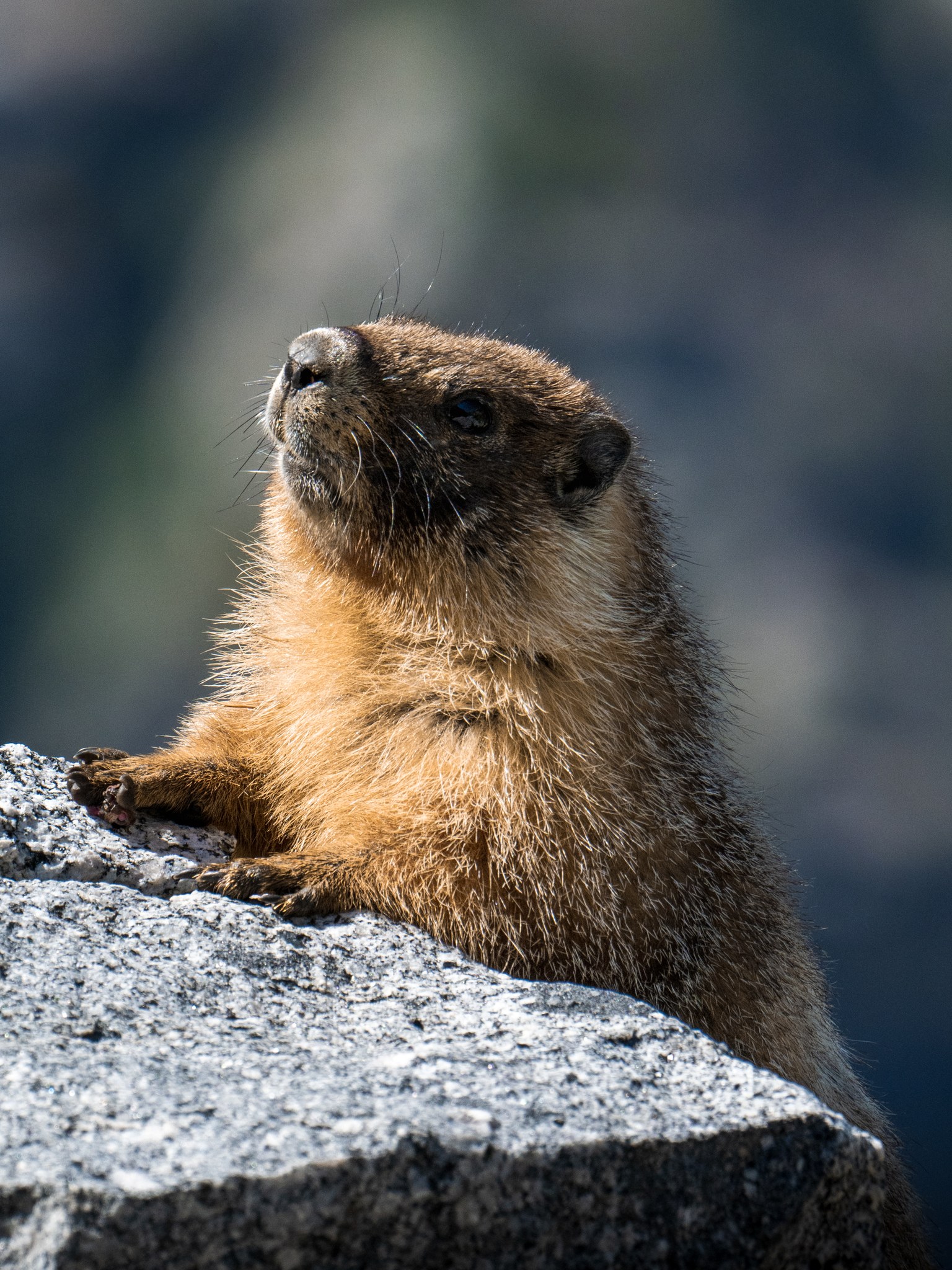
The 150–500 needs more explanation. Nearly four pounds is a lot of weight to carry over a 10,700-foot pass on the theory that something might be far away and worth shooting. In the end it earned its place three times: a marmot on day two, a single backlit foxtail pine on day three, and the Sierra crest turning pink at dawn from the summit ridge of Whitney — compressed at 172mm in a way a wide lens simply can't do.
My camping gear is the same kit I've listed in my LighterPack — with the caveat that the photography section of that list was different on this trip, and everything else is accurate.
Day 1 — Crescent Meadow to Buck Creek
The first eleven miles are the friendliest on the trail: a long traverse above the Middle Fork of the Kaweah with the Great Western Divide in front of you the whole way. It's also the busiest stretch, because Bearpaw Meadow is a destination in its own right.
And it's where I met my first bear.
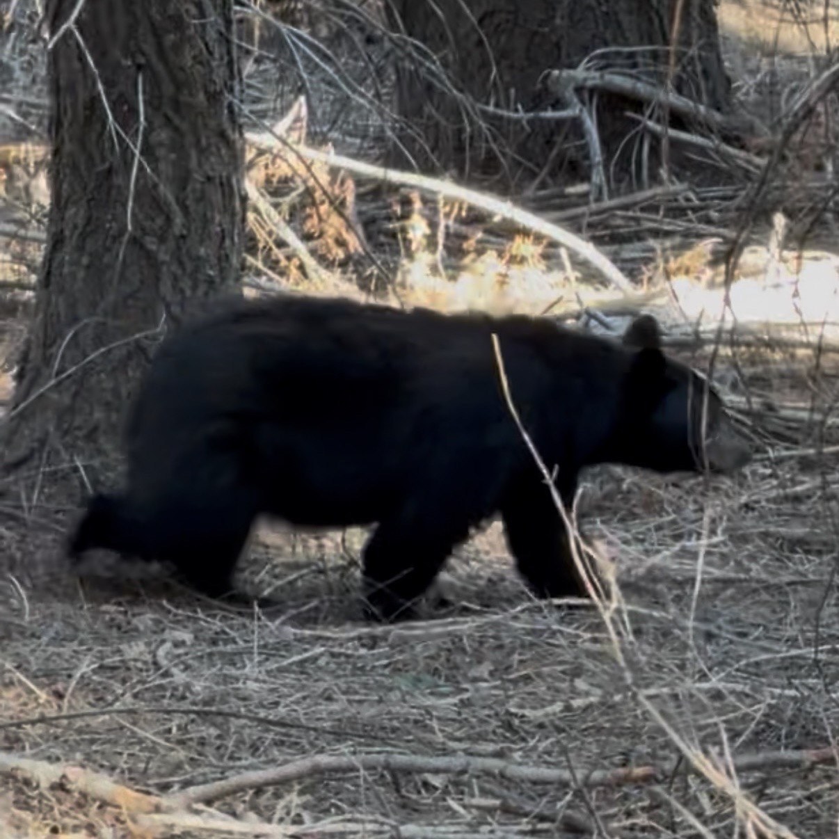
Half the hikers we talked to that afternoon had seen a sow with two cubs. This wasn't her — a lone male, completely uninterested in us, moving through the trees like we weren't even there. I got my shot and we kept walking.
We camped at Buck Creek, just below Bearpaw.
Day 2 — Buck Creek to Hamilton Lakes
A short day, five or six miles, and all of it worth slowing down for. The trail climbs into the granite and the walls start closing in.
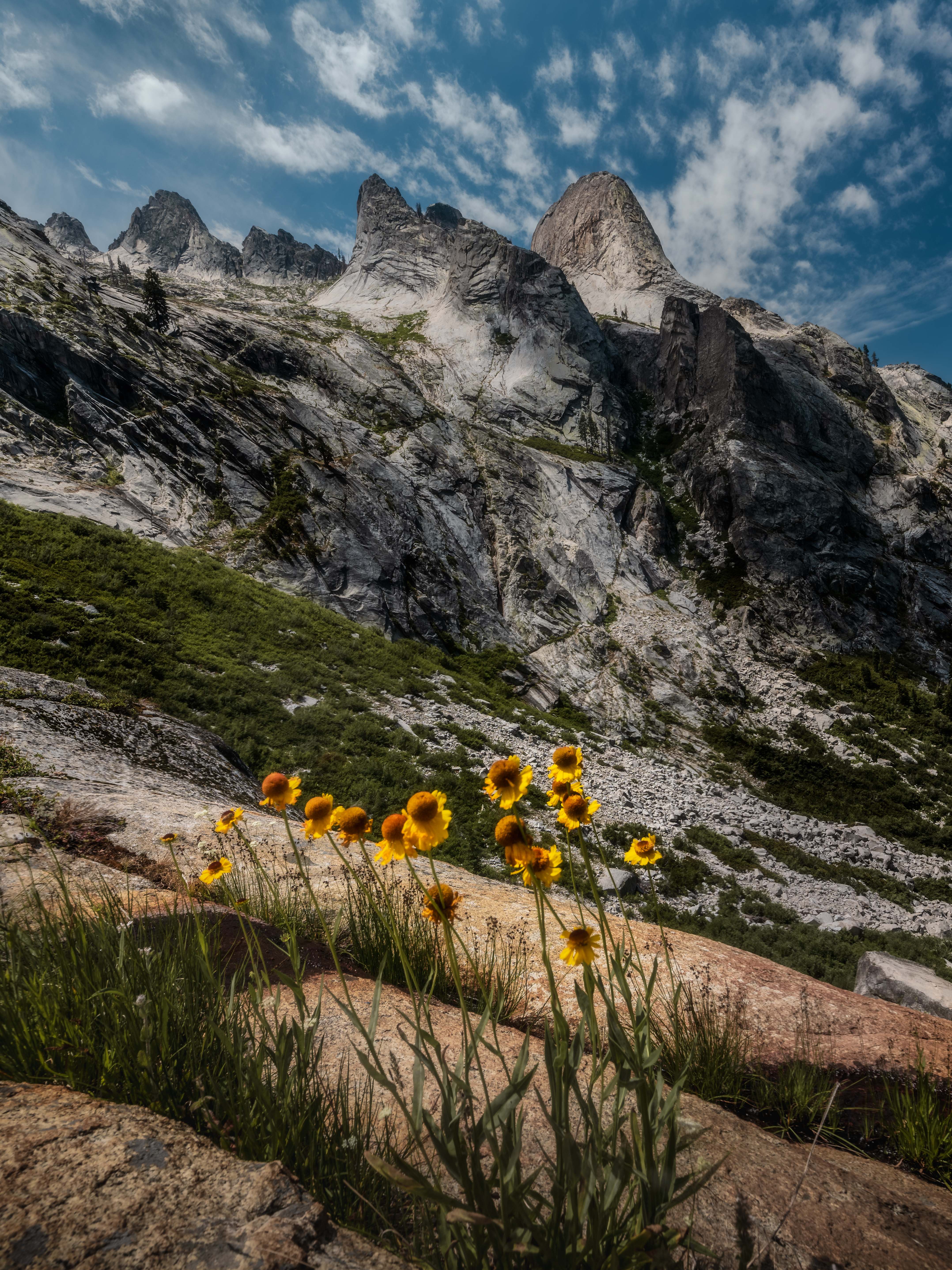
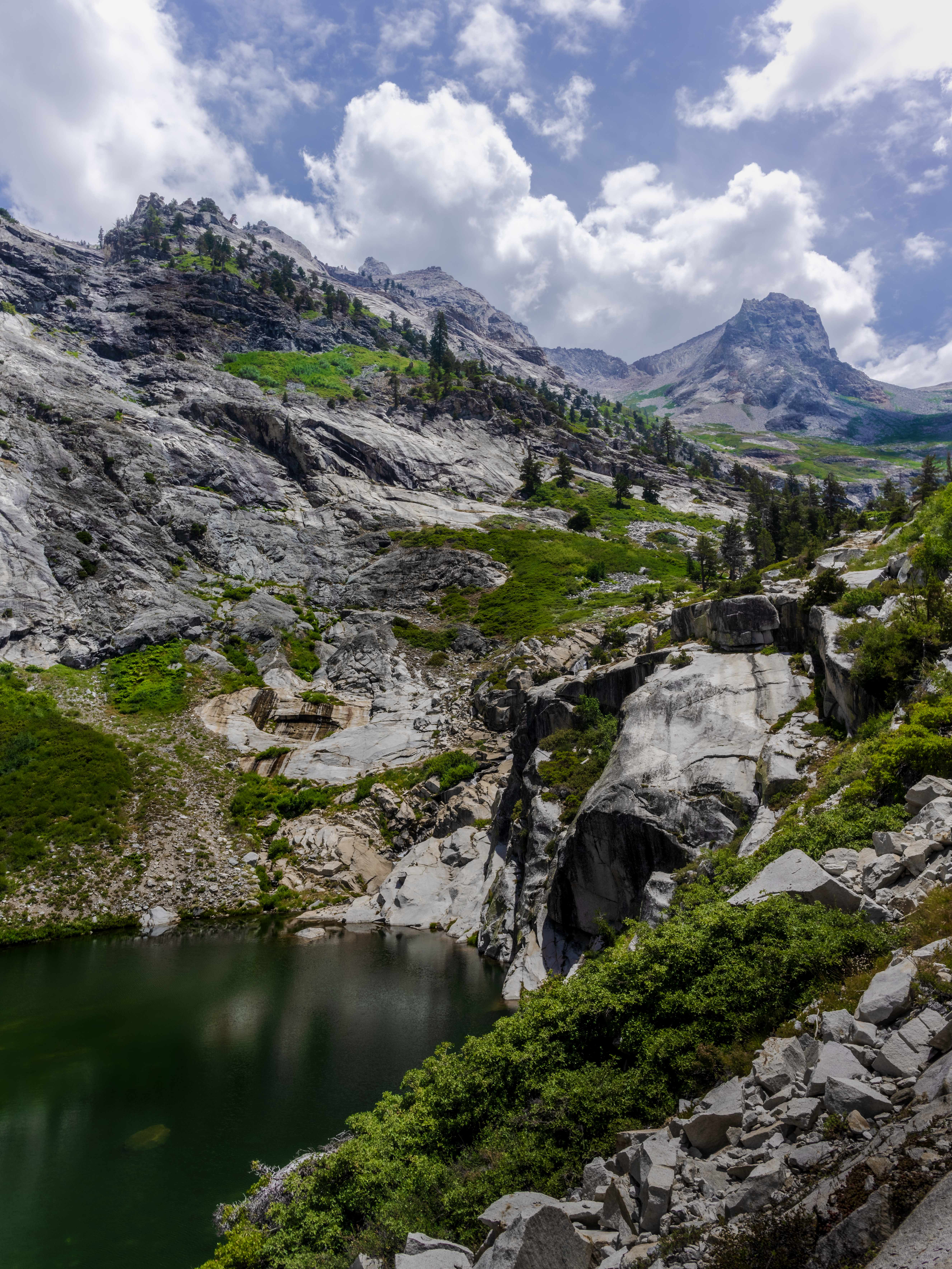
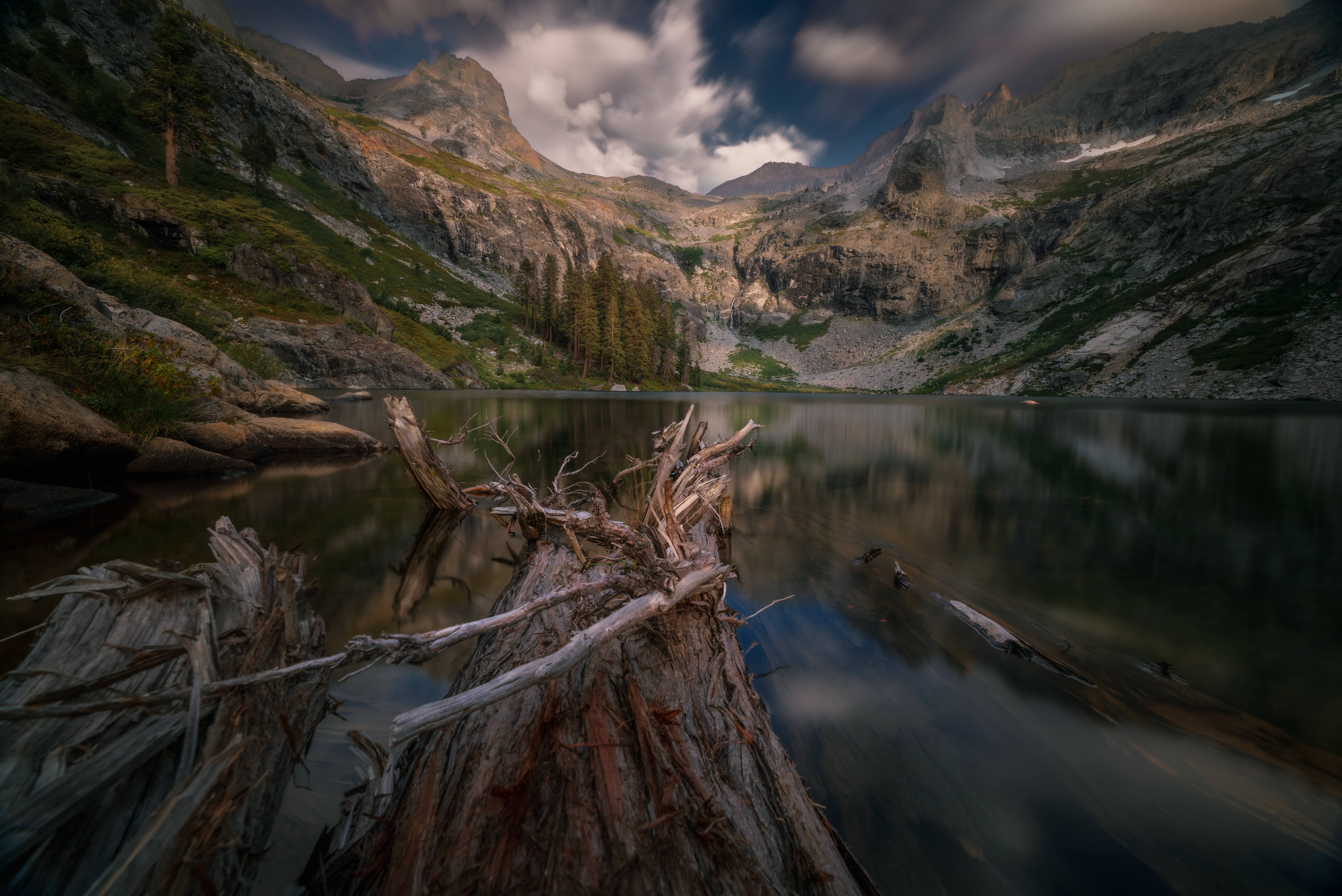
The Hamilton Lakes sit in a cirque under Mount Stewart and Cherubin Dome, with Hamilton Dome and the spires of Rowell Tower and Serpent's Tooth closing off the south side, and it's the single most photographed place on the High Sierra Trail for good reason. It's also where the trail's character changes: this is the last easy water, the last comfortable camp, and the point where a lot of people turn around and walk back out.
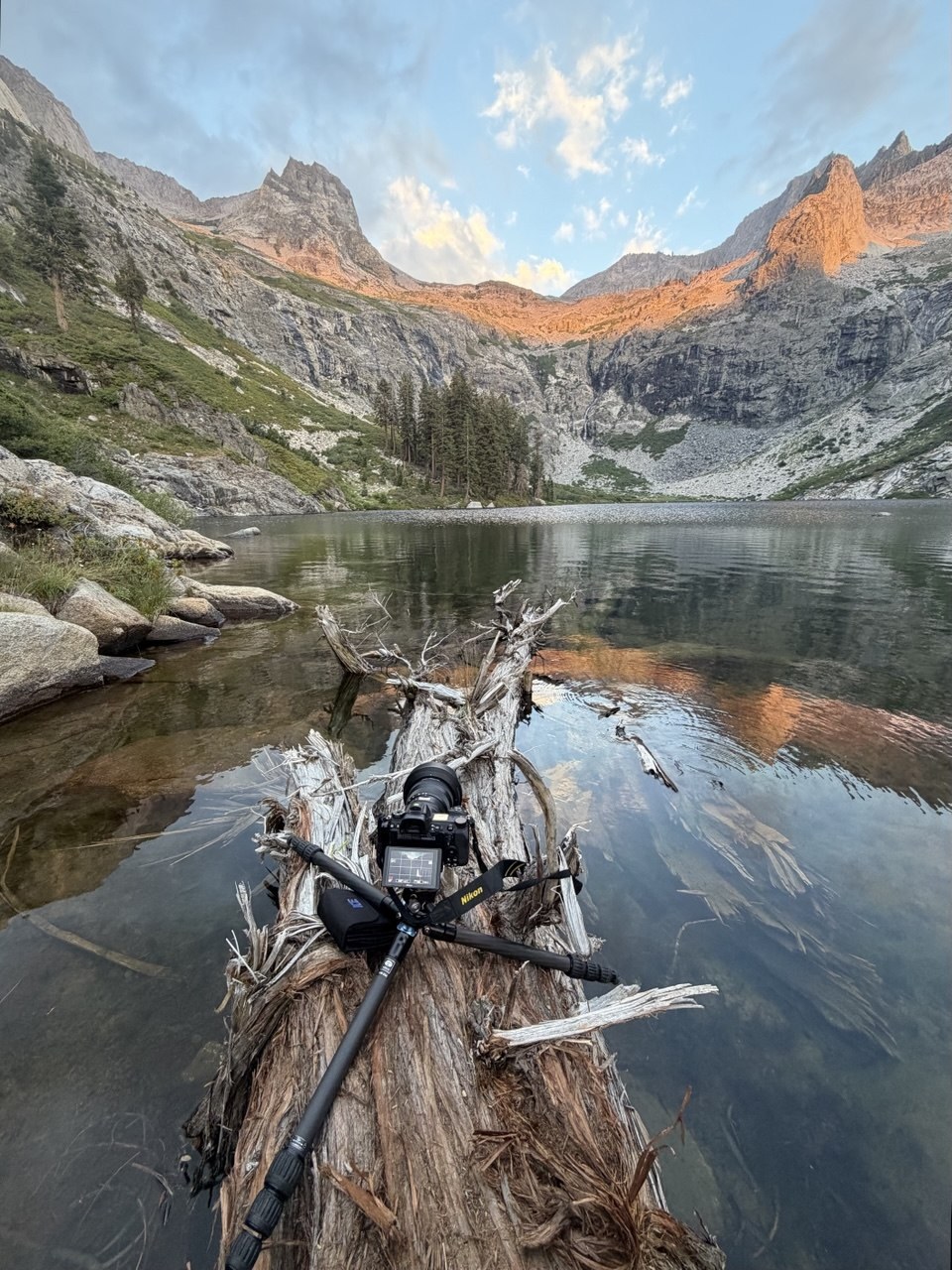
I spent the evening standing in the lake — on a half-submerged log, with the tripod's legs in the water.
Robert's theory about the fish
Robert — who I hiked the John Muir Trail with the year before, and who comes out from the East Coast to walk these trails the way I come out to photograph them — fishes in the hours the rest of us spend sitting around. He caught exactly one trout at Hamilton Lake. One, in an alpine lake, in a place that should be full of them.
His explanation: Hamilton is 17 miles in and 17 miles back out, which makes it the perfect target for people who want to see a glacier-fed alpine lake without committing to a thru-hike. So a steady stream of anglers arrives, fishes the same accessible water, and leaves. The lakes deeper in the trail don't get that pressure.
As it turned out a day later, he was right — keep reading.
(If you plan to fish, you need a California fishing license.)
Day 3 — Kaweah Gap and Big Arroyo
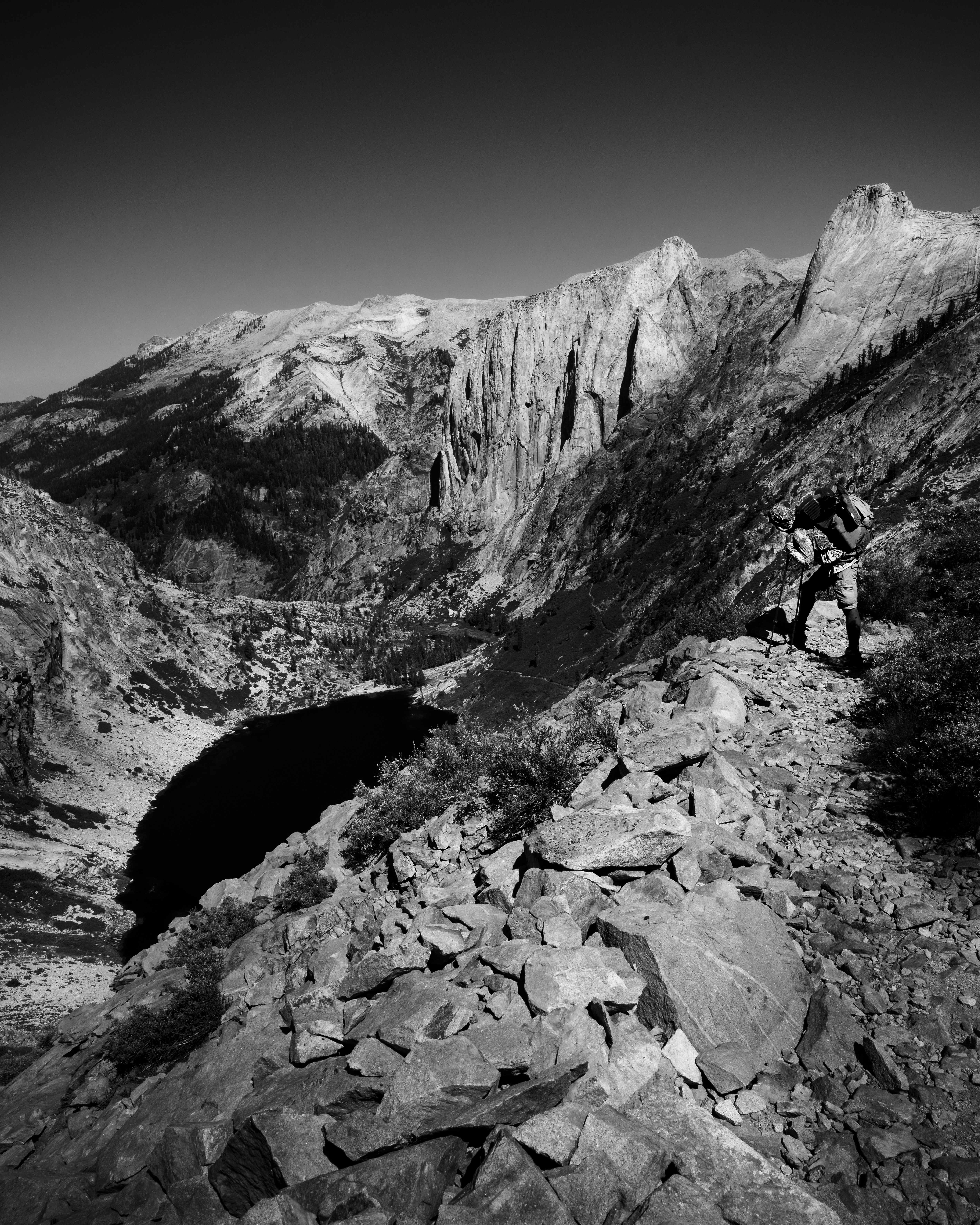
The climb out of Hamilton is the best-engineered mile of trail I've ever walked. It goes up the headwall in a series of blasted ledges and a tunnel, and every switchback opens the view a little further back down the canyon.
Above it sits Precipice Lake — the one Ansel Adams photographed in 1932 as Frozen Lake and Cliffs, still probably the most recognizable single frame from this whole range.
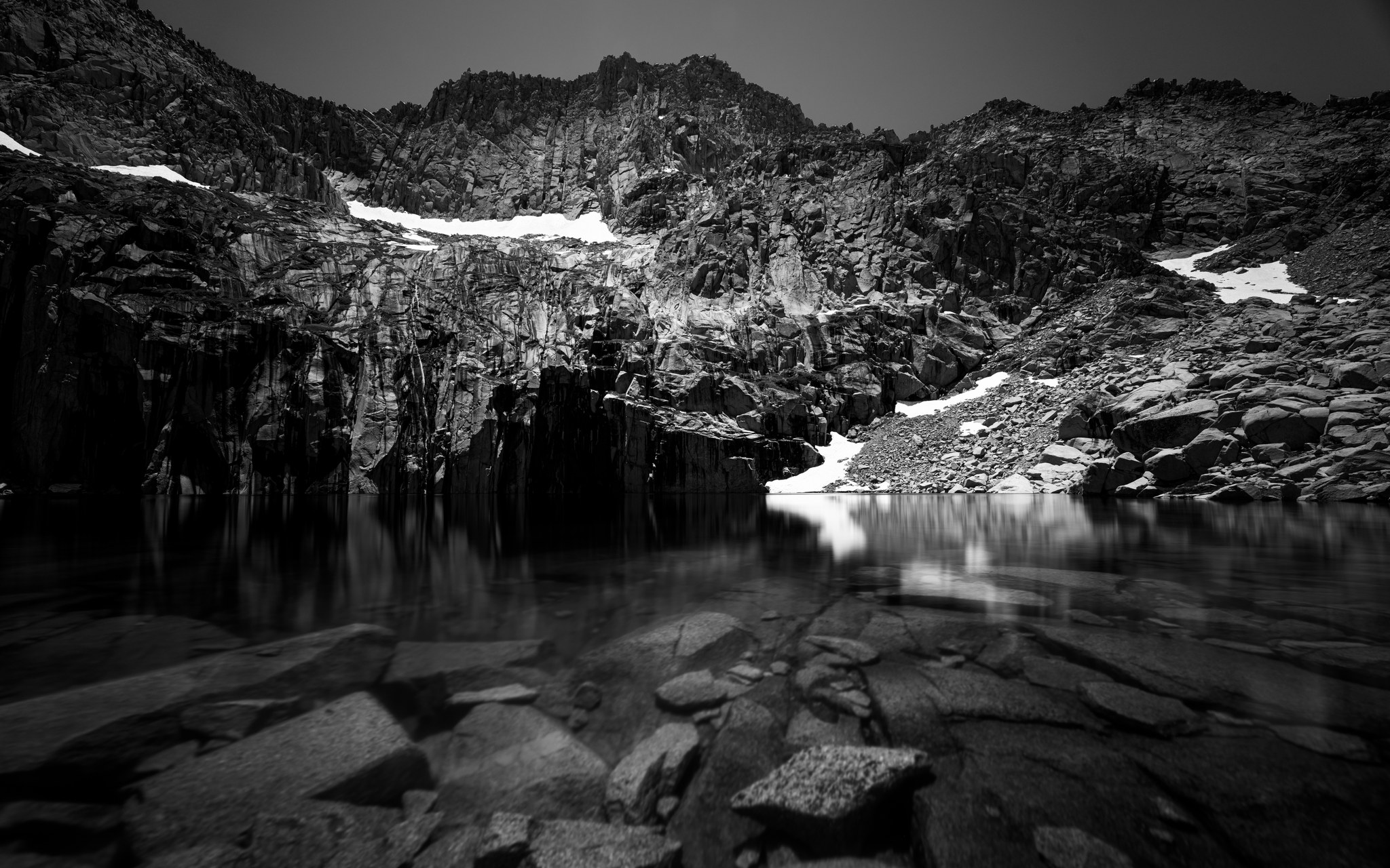
I got there at a quarter to one in the afternoon — the worst possible light, and on a point-to-point trail there's nothing you can do about that. So I put an ND on the front, shot thirty seconds to flatten the water, and committed to black and white from the start. If the light is wrong for color, in my experience it's better to stop fighting it.
From there it's a short climb to Kaweah Gap at around 10,700 feet, the trail's first real high point and the gateway into the Big Arroyo. The country on the far side changes completely: no more forest, just glaciated granite running for miles.
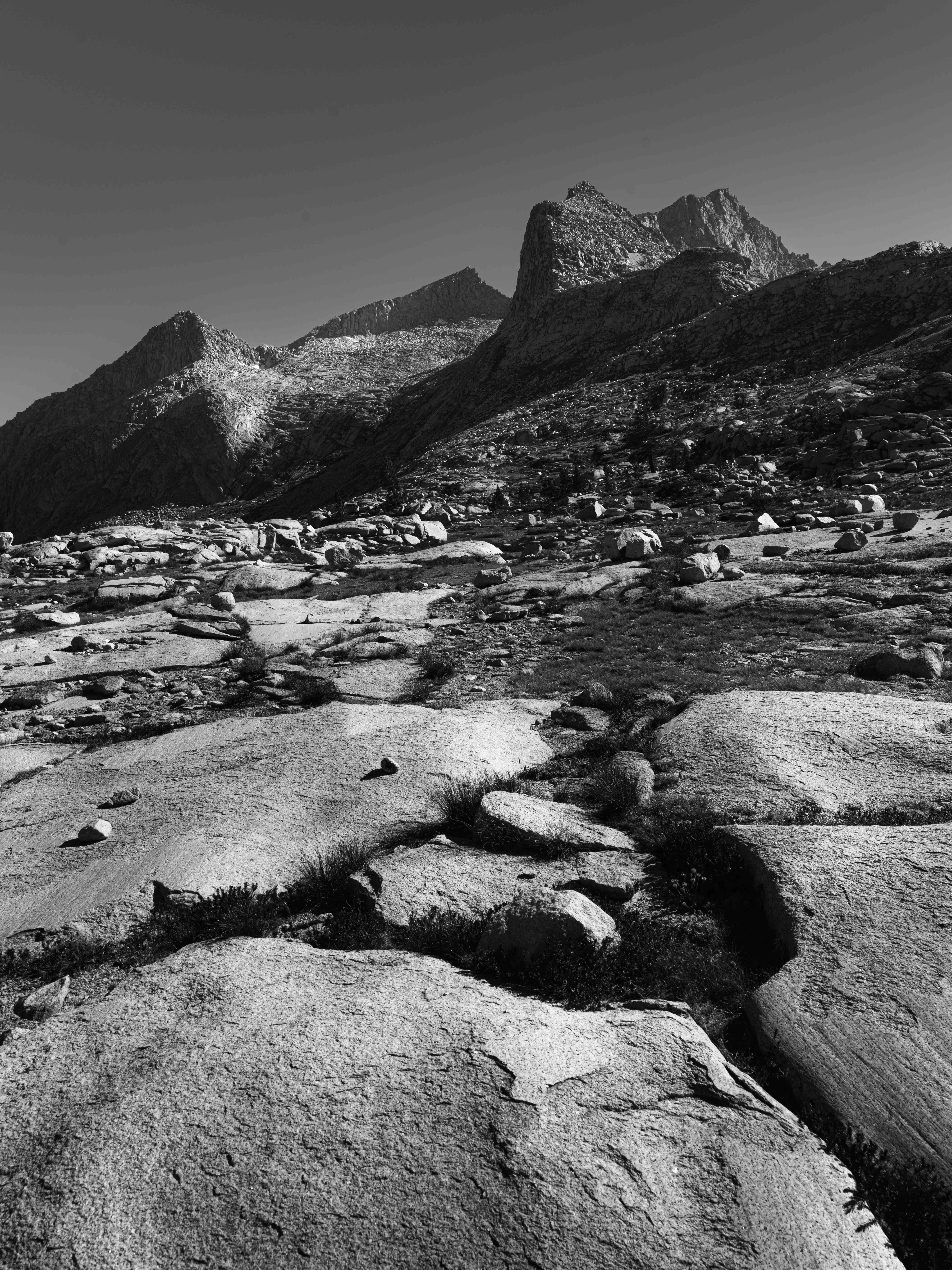
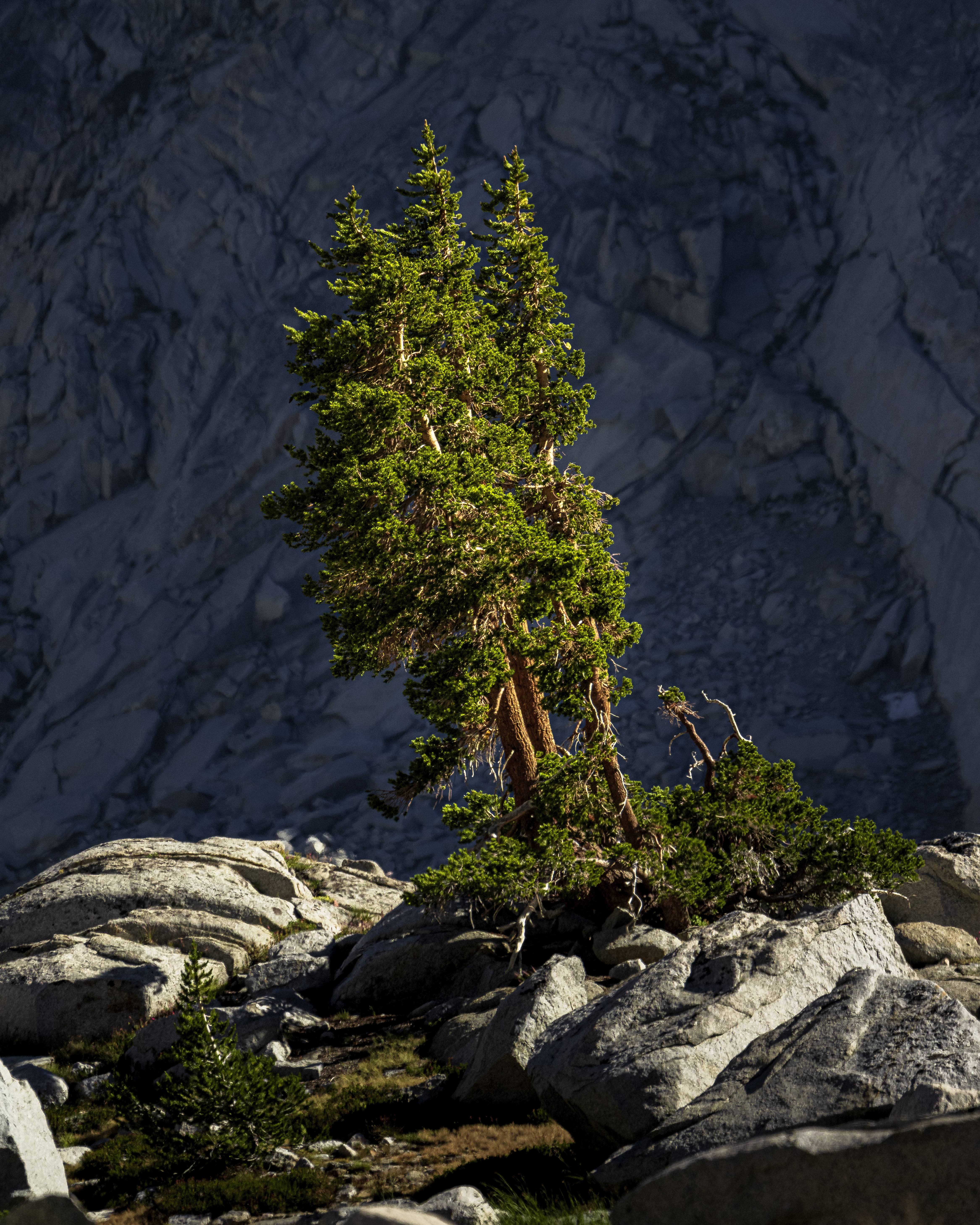
We camped by a lake just past the gap, and it turned out to be the best night of the trip in every way. Robert caught eight trout that evening — after exactly one at Hamilton. His theory held up.
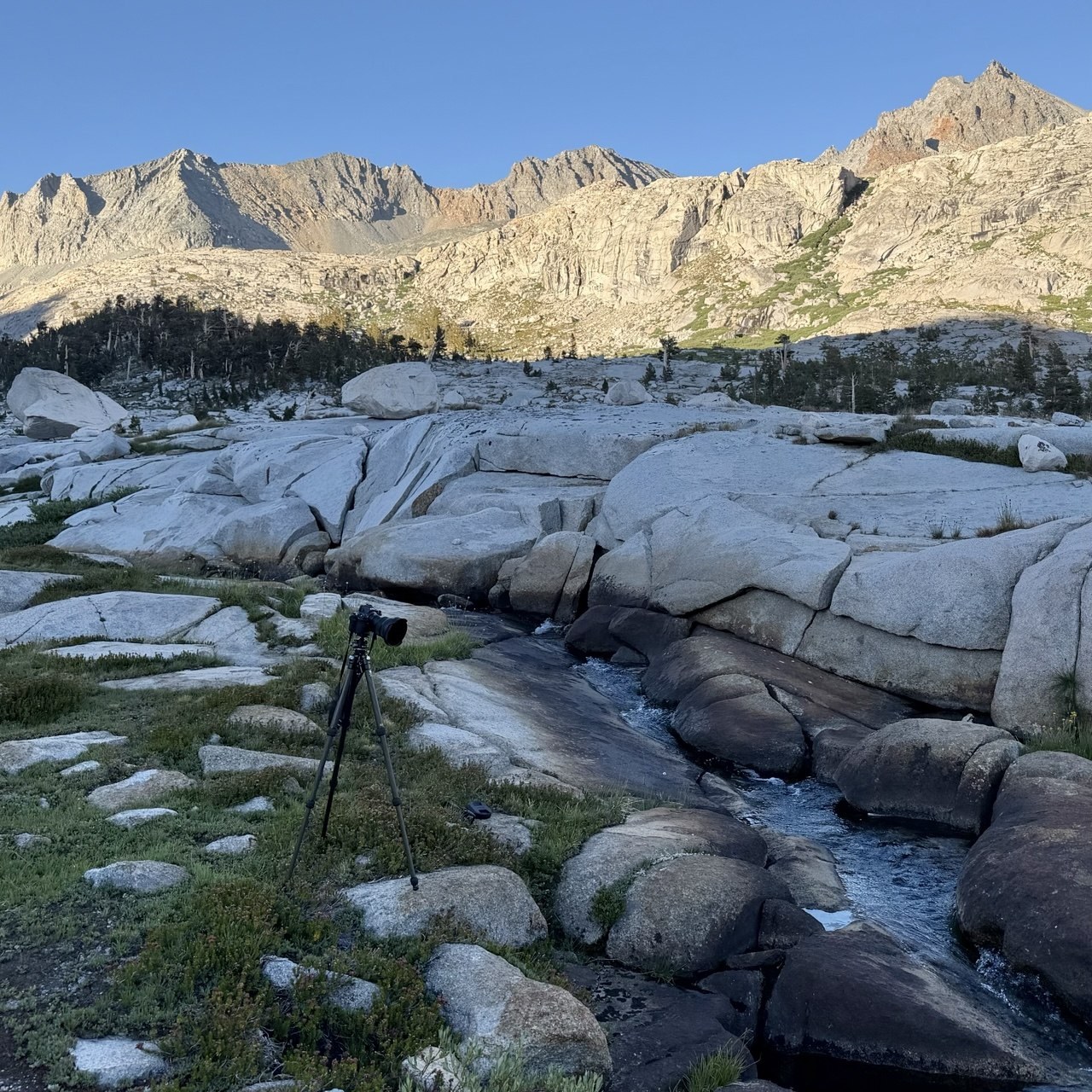
And then I spent most of the night working on one photograph.
I shot that creek three times: once in golden light, once at blue hour, and once properly after dark for the stars. None of the three worked on its own. Astro exposures give you a sky and a black hole where the ground should be; blue hour gives you granite you can actually see and a sky with nothing in it. The frame below is a time blend of two of them — the stars from the astro take, the foreground and middle ground from the blue-hour exposure, thirteen seconds at ISO 80 while there was still enough light to hold texture in the rock.
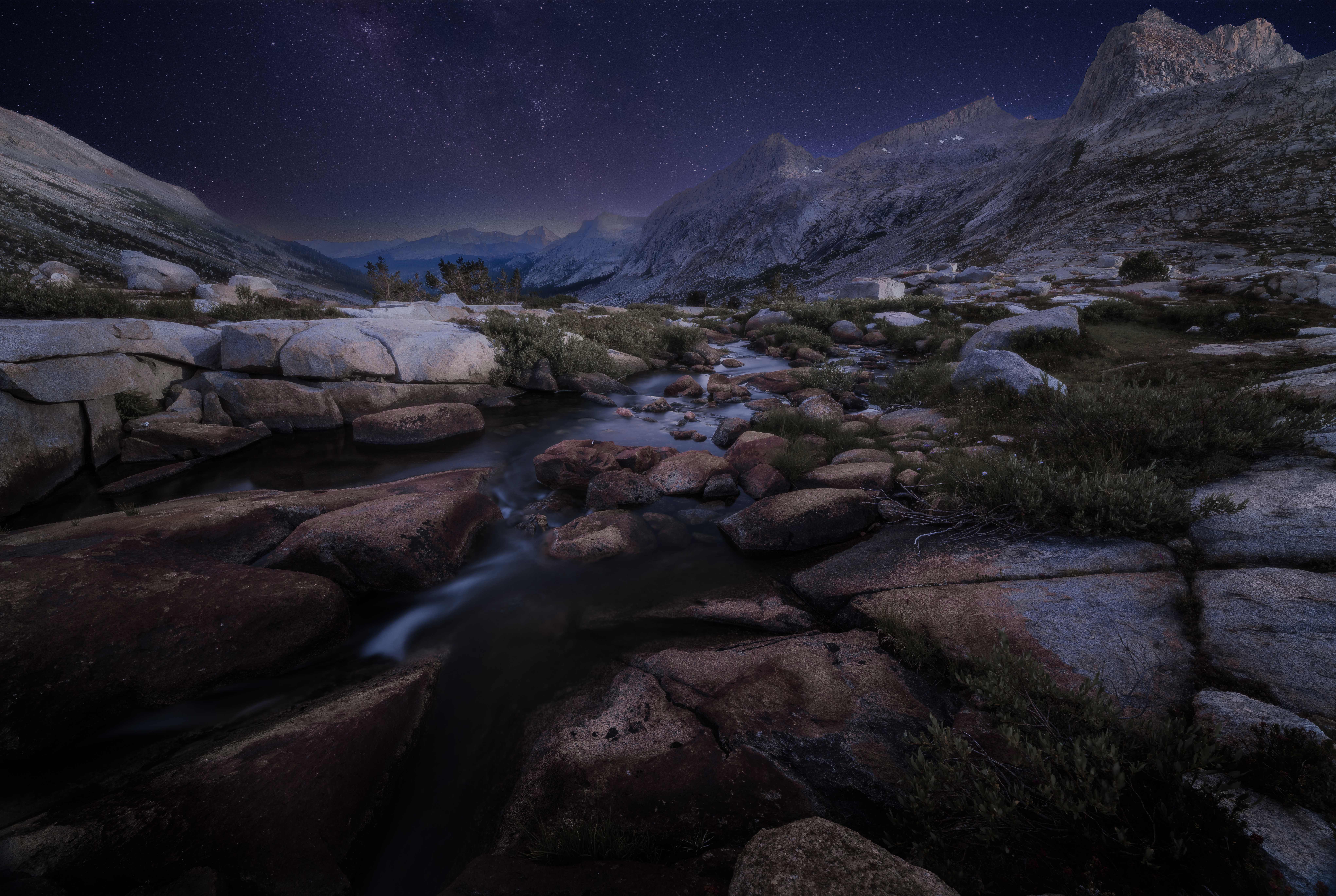
For me, this is the real argument for 1,280 grams of tripod — and it isn't the long exposures. It's registration: blending frames across three light phases only works if the camera hasn't moved a millimeter between them, and no technique gets you that handheld.
Day 4 — Chagoopa Plateau to Moraine Lake
This is the day the trail stops showing off.
Getting up onto the Chagoopa Plateau is a substantial climb — bigger than the profile makes it look, because it comes after two days that have already emptied your legs. The plateau itself is high, flat, forested and, right after the Big Arroyo, surprisingly ordinary. You walk through trees for hours.
There's one more thing about this stretch that nobody warned us about in advance: the trail down toward Moraine Lake and the Kern junction has its own rattlesnake reputation. One hiker we met told me that seven years earlier he'd counted eight of them on the walk in to the lake. We saw none that day — I still spent a lot of the afternoon watching the ground.
I was completely done by the time we reached camp, and I didn't make a single photograph worth keeping. That happens on long trails more often than photographers like to admit: some days are just transport, and it took me a few big trips to stop feeling guilty about it.
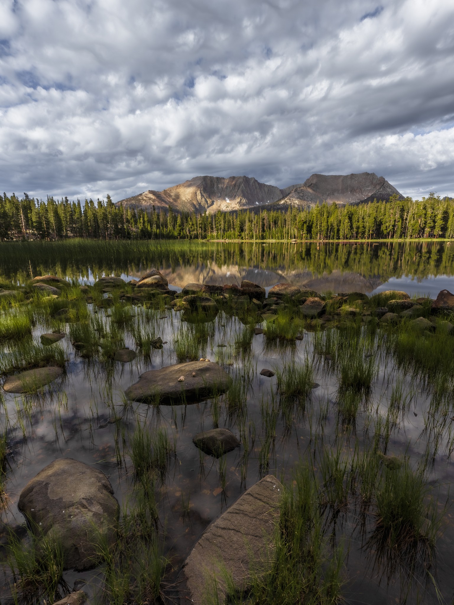
The lake made up for it in the morning, on our way out:
Day 5 — down to the Kern: the hardest day on the trail
The hardest day on this trail is not the pass, and it's not the summit. It's the day the elevation profile says should be easy: the long descent to the Kern River at 6,670 feet, and the walk up the canyon to the junction with the Kern River Trail.
It was one of our longest days. The canyon is the lowest point of the entire route, which in July means heat that sits between the walls and doesn't move. Long sections are burned, and the parts that aren't burned have grown back over the trail so thick you can't see your own feet.
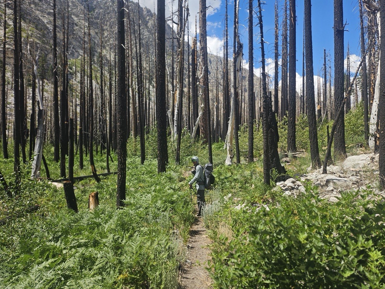
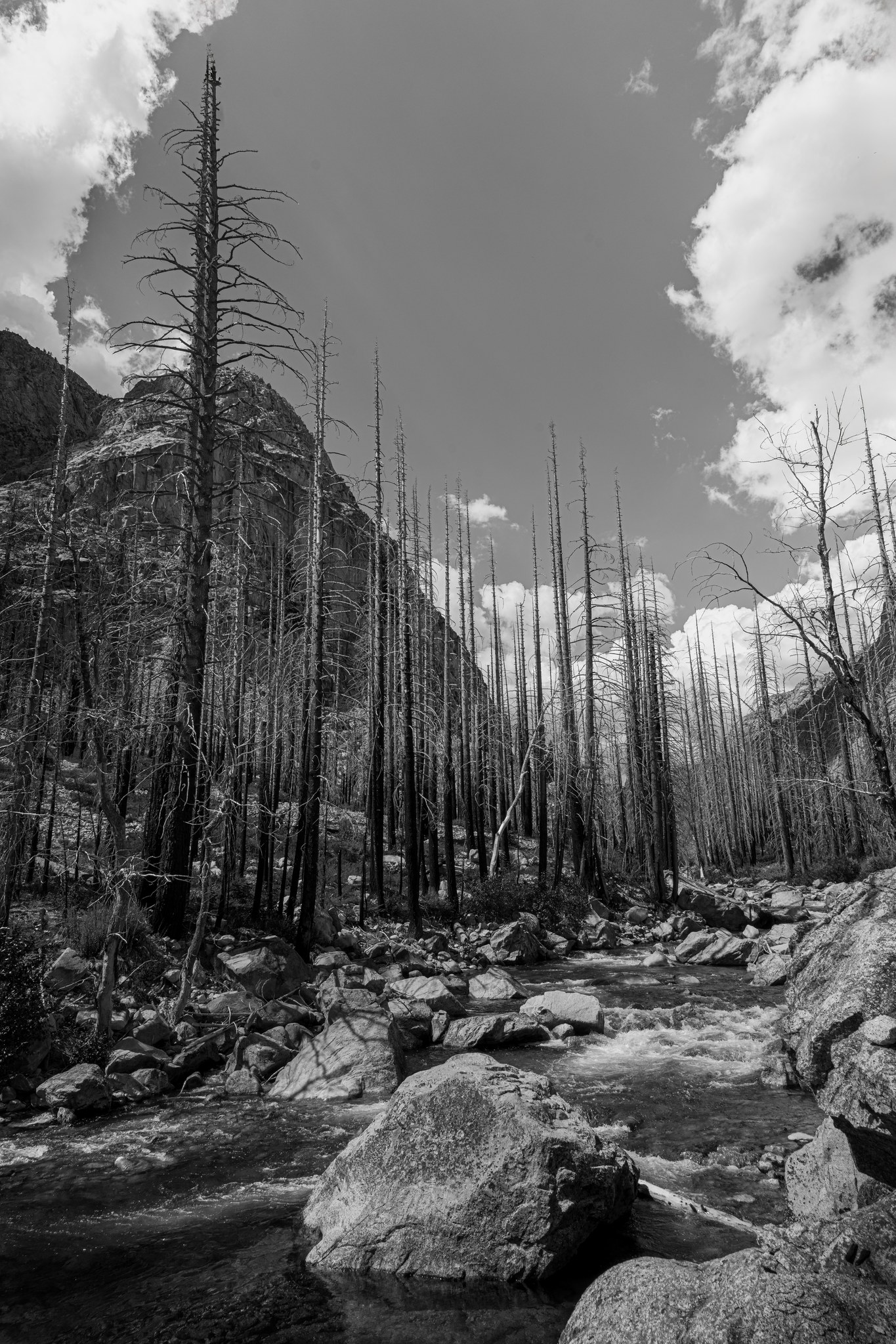
And the Kern canyon is notorious for rattlesnakes. Rangers warned us, other hikers warned us — and then we met one ourselves:
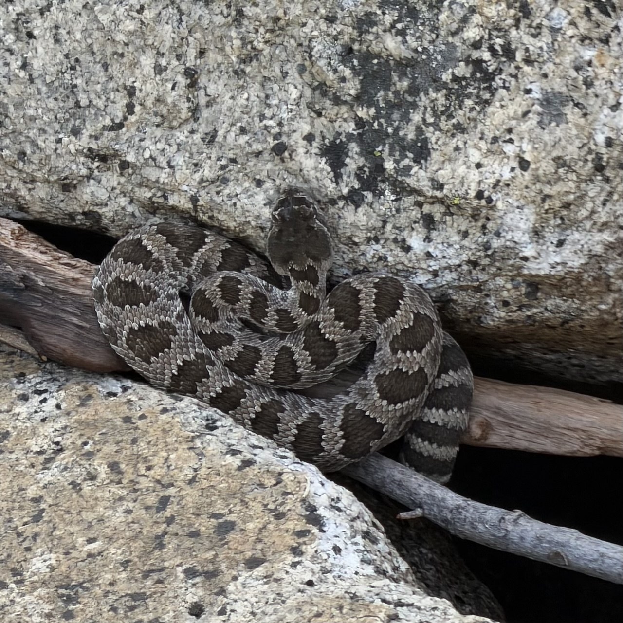
Hot, long, overgrown, burned — and you're watching the ground instead of the light. I barely took a photograph that day. Partly there was no time, since we had miles to make, and partly I did not want to be the guy who stepped off-trail for a better composition and got bitten eight miles from anything.
If you walk the High Sierra Trail, budget your energy for this section, not for Kaweah Gap. There's no dramatic elevation change here, and it was still, without question, the hardest part of the trail.
Day 6 — up to Guitar Lake
On paper this is the big one: the climb out of the Kern, up Wallace Creek to the John Muir Trail, then south past Crabtree to Guitar Lake at about 11,500 feet. You spend the entire day winning back the elevation the canyon took from you.
In reality it wasn't that hard, for two reasons.
The first was the weather — overcast all day, which after the Kern canyon felt like a gift rather than a disappointment. The second is the thing I'd most want a first-time Sierra hiker to understand: we'd been gaining altitude gradually for six days, and neither of us had a single symptom of altitude sickness the entire trip. People fly into Lone Pine, drive to the Portal, try to climb 14,505 feet in a weekend, and then wonder why they feel destroyed at Trail Camp. Walking in from the west is the slow, unglamorous, and very effective way to acclimatize.
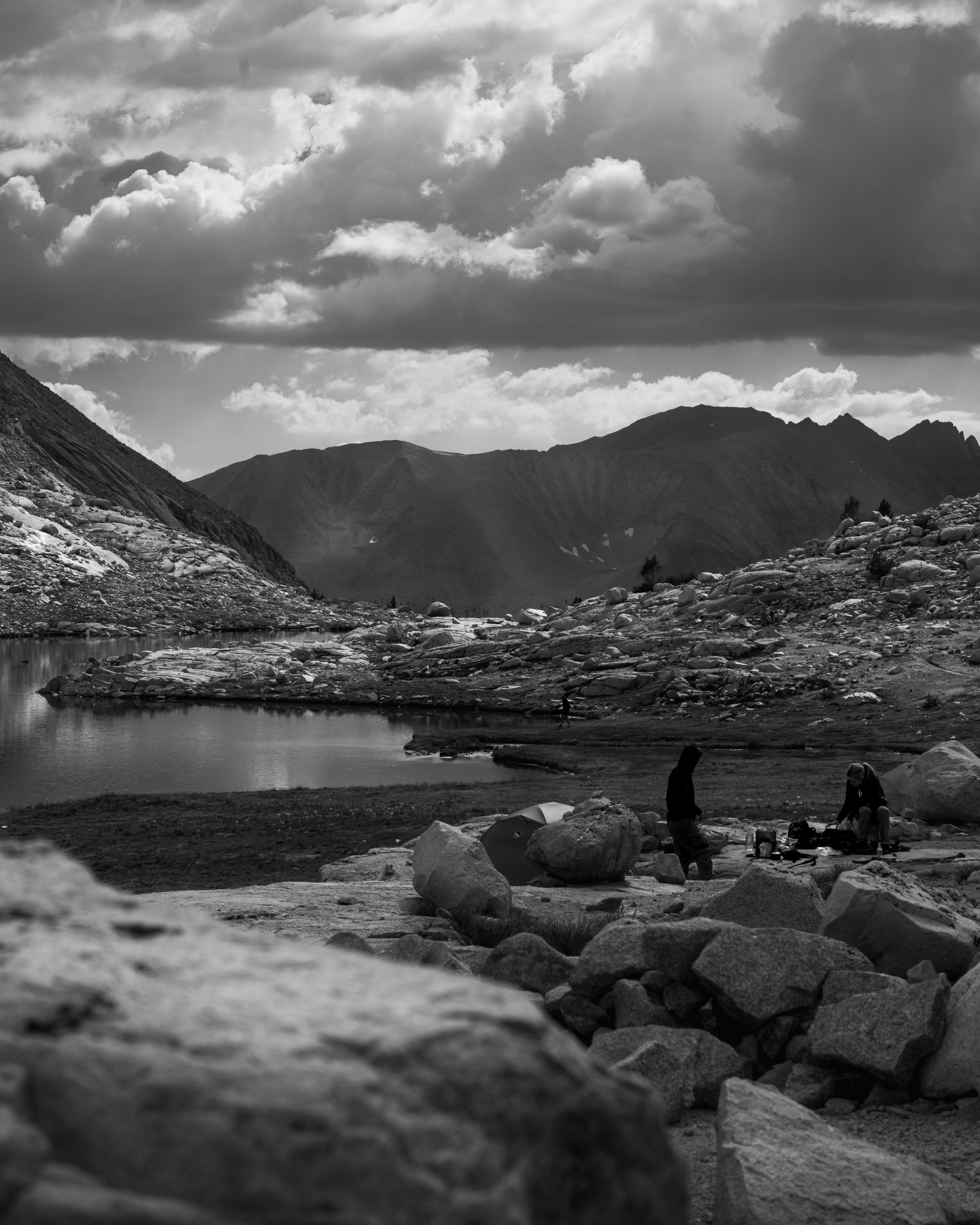
We got to Guitar Lake and hunkered down, and shortly afterwards it rained. Not much and not for long, but enough to make us take the forecast seriously.
That evening the basin filled up with people all planning the same summit morning. Everyone was tired, everyone was prepping, and Robert and I spent a while arguing about what time to start. That conversation happens at Guitar Lake every single night in July, and there are two rules it should be settled by:
Don't go up if the mountain is in cloud, and don't go up if you can hear thunder. Don't "start and see how it goes" — the pass and the summit are the two places you can't quickly retreat from.
Be over the high ground before noon. In July, Sierra storms build in the afternoon with real reliability. Whatever time you plan to summit, work backwards from being off the top and heading down before the clouds start stacking up.
We'd already had rain two days in a row, and two days after we summited there was a flash flood on Whitney. That's the context in which we picked our start time — and we picked 1am.
Day 7 — Whitney at 1am
Starting at one in the morning is not about romance — it's a safety margin. It puts you on the summit at dawn and well down the east side before the afternoon has a chance to do anything about it.
The bonus was arriving high on the mountain at exactly the right time:
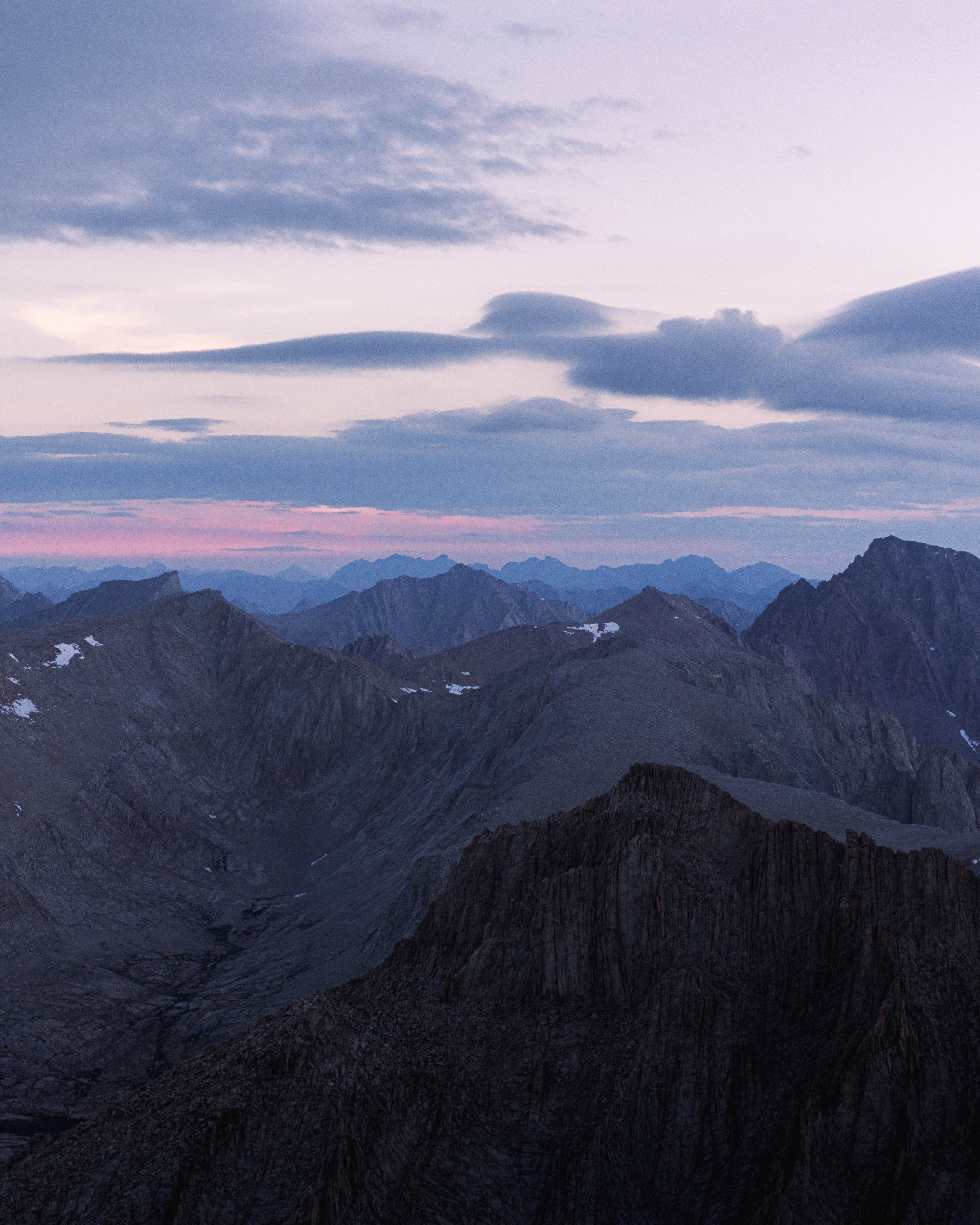
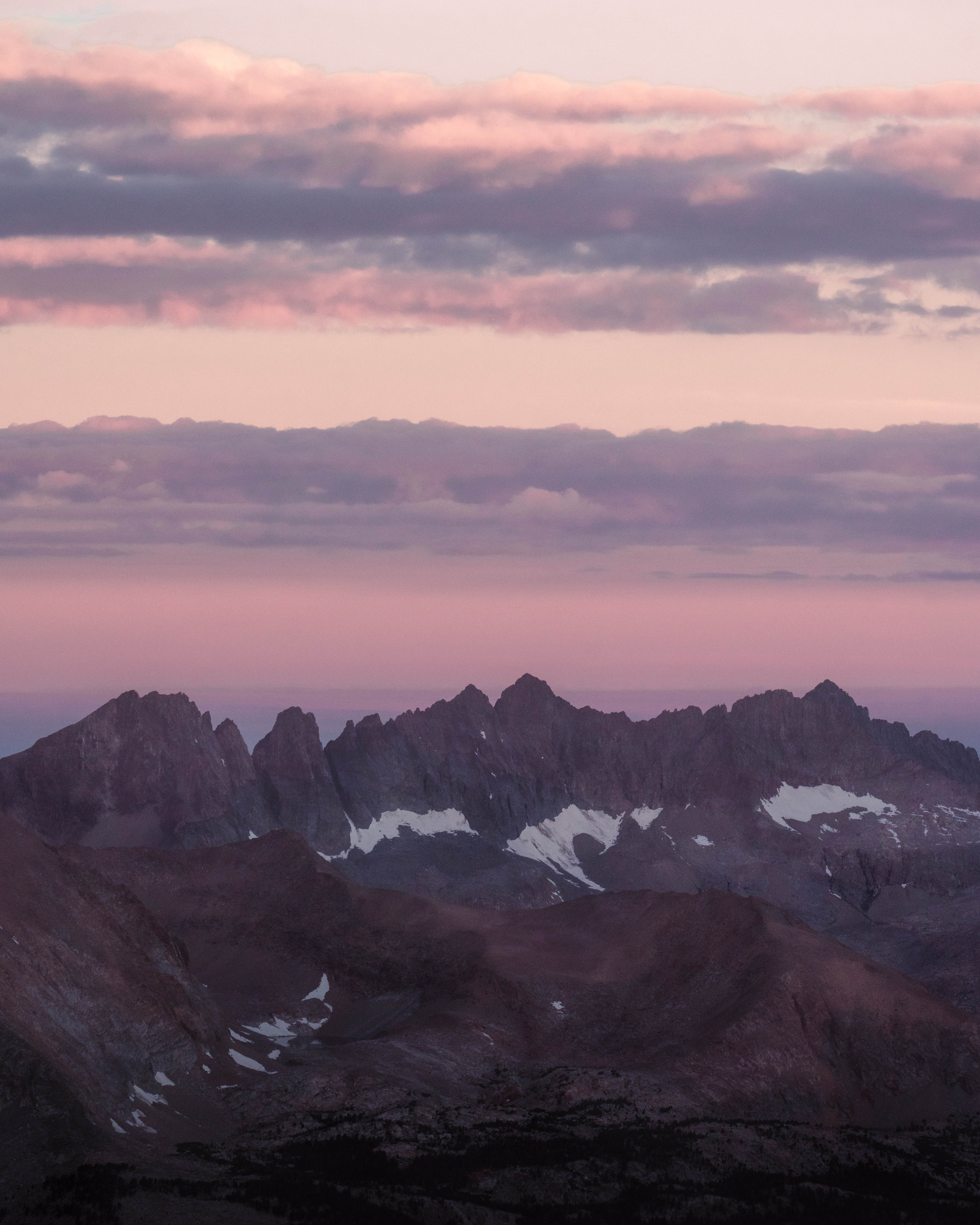
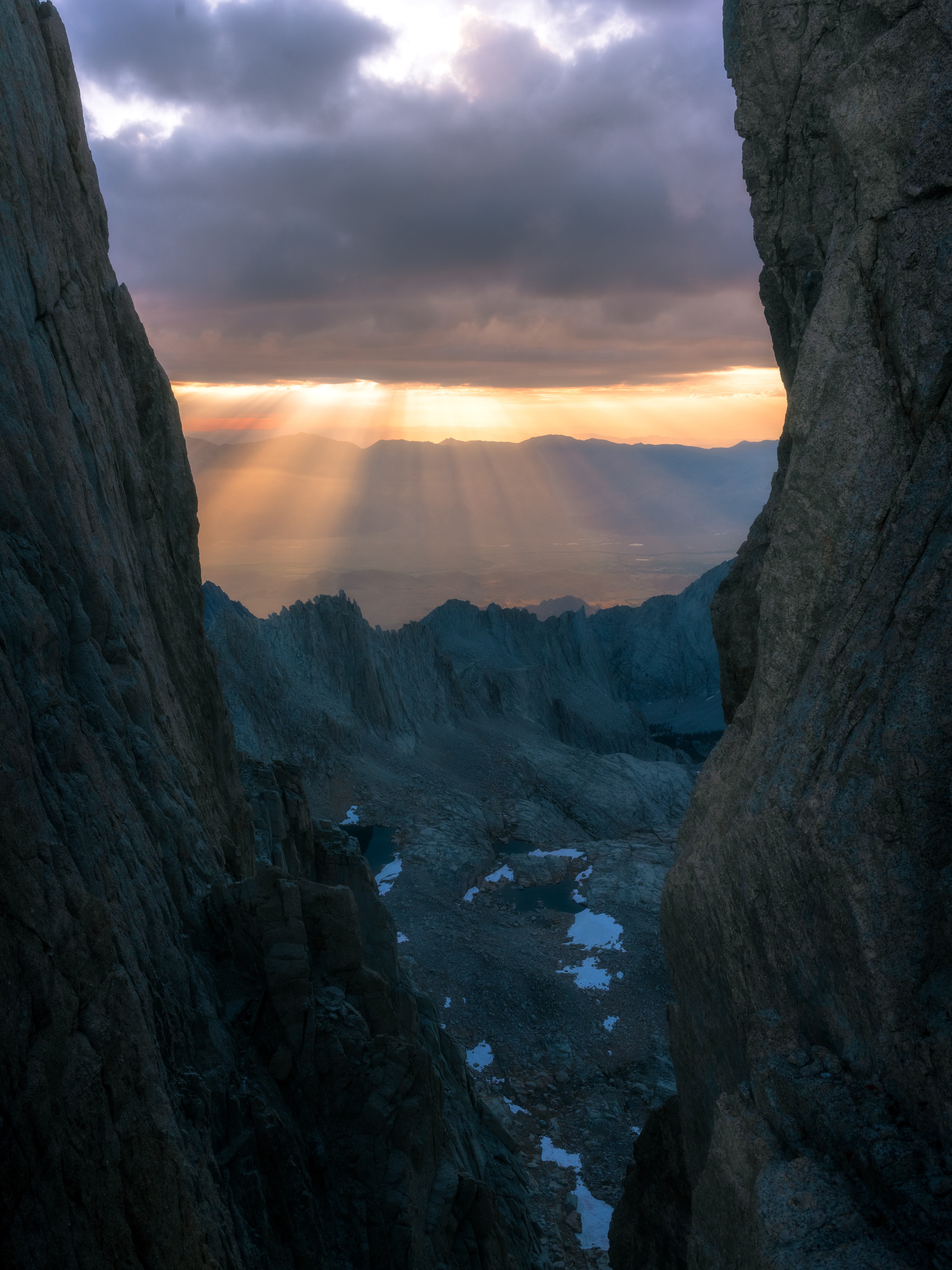
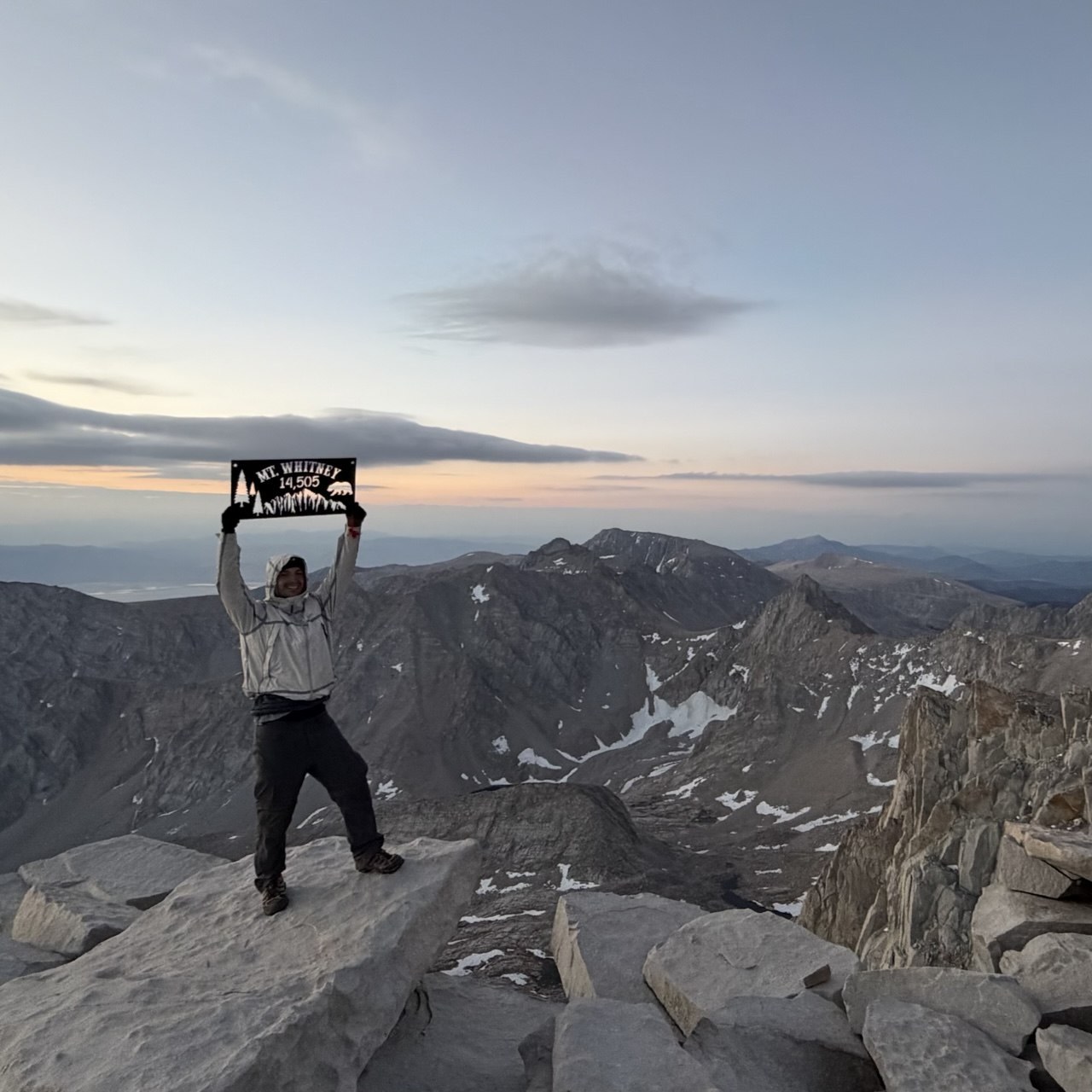
Then the descent: over Trail Crest and down the switchbacks toward Trail Camp, with the light finally coming over the ridge behind us.
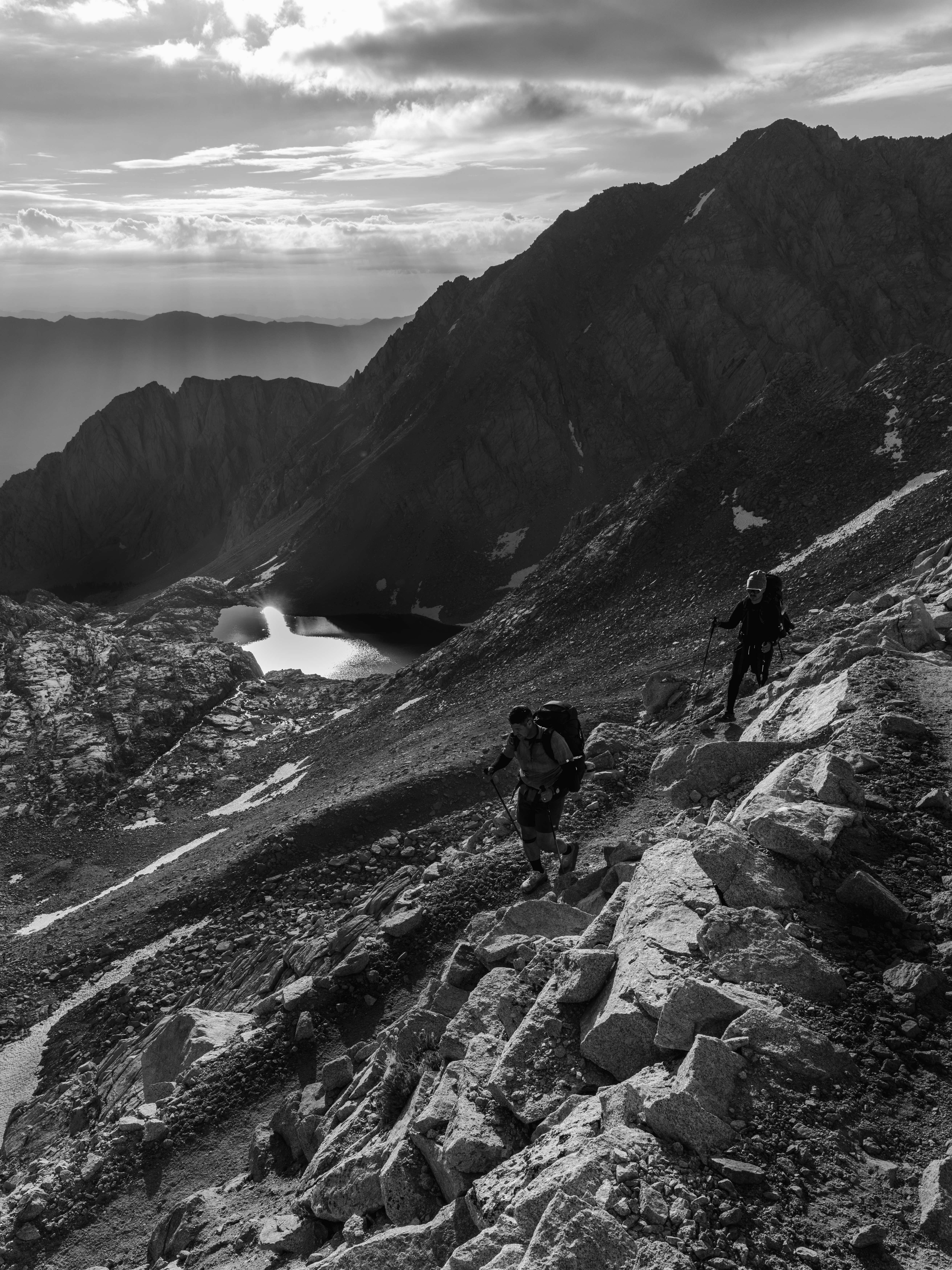
We came out at Whitney Portal, and as we drove away from Lone Pine, Highway 395 was closed northbound for a fire. That's July in the Sierra for you.
Shooting the High Sierra Trail
A few things I'd tell myself before going back:
The good light is at both ends of a long day, and you'll be walking through both. On a point-to-point trail you don't get to sit at a viewpoint and wait. The compromise that worked for me was choosing camps for their photography — Hamilton and the Big Arroyo both — and accepting that the middle of the day is for covering ground.
Carry the tripod. Two of the best frames from this trip are blends: Hamilton is bracketed exposures combined for dynamic range, and the Big Arroyo creek is a time blend built from light phases hours apart. Both need the camera to stay in exactly the same place between frames. Long exposures are the obvious reason to carry a tripod, but for me frame registration is the more important one.
Watch the afternoon build. July in the Sierra means convective storms. Photographically that's a gift — the clouds on days 3 and 6 are the reason those frames work — but above treeline it's a serious hazard. Plan the high, exposed sections for the morning.
Black and white solves the mid-day problem. A lot of this trail is gray granite under a hard blue sky, which is a difficult color photograph and an excellent monochrome one. Precipice Lake at 12:45 is the clearest example — in color that frame is nothing special. Several others here were only ever going to work the same way.
Altitude is a photography problem too. Above 11,000 feet, getting out of the sleeping bag at 4am to shoot something is a much harder decision than it is at sea level. Sleep low if the itinerary lets you.
High Sierra Trail or the John Muir Trail?
Having now walked both, here's my honest comparison.
The JMT is 211 miles and takes most people two to three weeks. It's a commitment of a different order, with resupply logistics, and it's busy.
The HST gets you a huge amount of the same country — the Great Western Divide, the Kern, the JMT's final stretch, and the Whitney summit — in about a week, with no resupply and, crucially, no Whitney lottery. For a first Sierra thru-hike, or for a photographer who wants the high country without a three-week block of time, I think it's the better trail. It's not easier per mile — it just ends sooner.
If you want the long version, my John Muir Trail photographs are on the site day by day.
What I'd do differently
Carry less. I say this knowing I'd bring the 150–500 again. But everything else in that pack could have been lighter, and on day five it mattered.
Go earlier in the season. Heat was the defining difficulty of this trip, and it's the thing almost everyone underestimates. We met a lot of hikers who were struggling, and heat came up in every one of those conversations. Earlier means more snow at Kaweah Gap and more water in the creeks — I'd take that trade.
Take the trail seriously. Nearly every day has a real climb in it. The mileage is modest by thru-hiking standards and the profile looks manageable on paper — and neither of those tells you what the Kern canyon feels like in July.
If this helps you plan your own walk across the Sierra, or you just want to see how the week looked through my lens, the full set is waiting in the High Sierra Trail gallery.