Most people drive Highway 395 through the Eastern Sierra with a day or two, on their way somewhere else — Mammoth, Tahoe, Yosemite over Tioga — and want to know which of the famous stops are worth the time and where to sleep between them. That's the question this post answers, and I want to explain up front why I'm the one answering it.
I spent five days on this stretch in August, northbound from Lone Pine to Mono Lake, doing what a landscape photographer does: sitting at the same handful of places at the wrong hours and the right ones, going back when the light was better, sleeping as close to each one as I could so I could be there at 5am. That's a slow, inefficient way to travel — and it's the only way to learn which two hours at each stop actually matter, which detours pay off and which don't, and what the campgrounds are like when the forecast lies. It lied all week: clear skies were promised, and I got thunderstorms on four days out of five, hail at Convict Lake, a NOAA flood watch, and a rear tire cut open on a campground road in the White Mountains. I also came home with the best set of photographs I've made in a single week.
Highway 395 runs the length of the Eastern Sierra, and everything in this post is on the highway or within an hour of it on a paved road — which is the point. Unlike the John Muir Trail or the High Sierra Trail, you don't need a permit, a bear canister, or three weeks. You need a car, a tent or a motel reservation, and one or two days — and, ideally, someone who's already spent five figuring out where to be at sunrise.
So: the one- and two-day plans come right after the map and drive times, built around light rather than a checklist. After that comes the long version, stop by stop, north from Lone Pine — where I stood, when, what it cost, where I slept, and what I'd tell a photographer with a tripod in the trunk. If you're only here for the plan, take the plan; the rest is the evidence.
Updated August 2026 — prices, hours and road conditions are what I found on August 9–14, 2026, checked against the Forest Service and BLM pages where they publish them.
The route: 125 miles of Highway 395 and five nights
Lone Pine to Lee Vining is about 125 miles and a little over two hours of driving if you never stop. I made it last five days, northbound, sleeping in three places:
| Night | Camp | What it's for |
|---|---|---|
| 1 · Sun Aug 9 | Lone Pine Campground | Alabama Hills and Mobius Arch, ten minutes away |
| 2 · Mon Aug 10 | Grandview Campground, White Mountains | The Ancient Bristlecone Pine Forest, five miles up the road |
| 3–5 · Aug 11–13 | Convict Lake Campground | Convict Lake itself, Hot Creek (15 min), Mono Lake (40 min) |
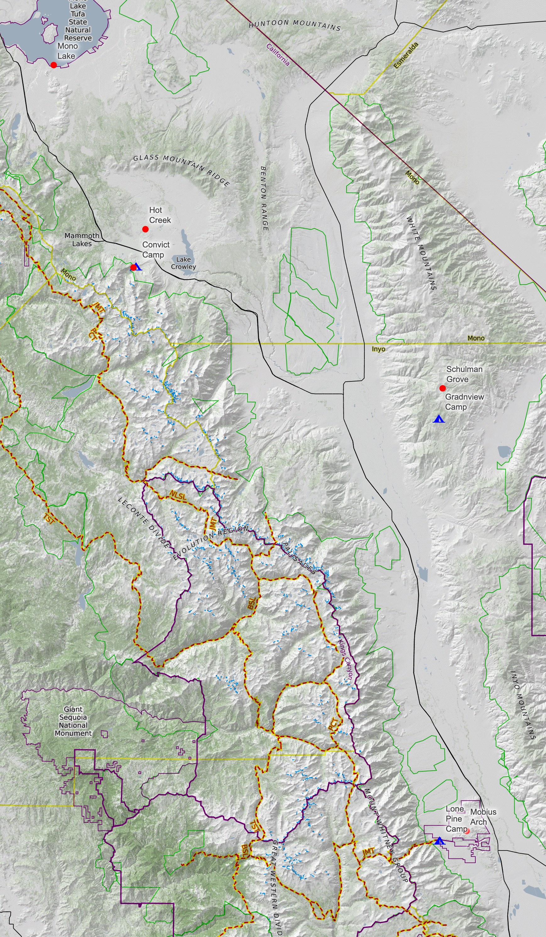
Drive times between the anchors, so you can do the arithmetic for your own trip:
| From → To | Miles | Time |
|---|---|---|
| Lone Pine → Mobius Arch (Movie Road) | 6 | 15 min |
| Lone Pine → Bishop | 57 | 1 h |
| Bishop → Grandview Campground / Schulman Grove | 32 / 37 | 50 min / 1 h |
| Bishop → Convict Lake | 38 | 40 min |
| Convict Lake → Hot Creek | 8 | 15 min |
| Convict Lake → South Tufa, Mono Lake | 35 | 40 min |
| Lone Pine → Lee Vining, no stops | 123 | 2 h 10 min |
The Bristlecone detour is the big decision on a short trip. It's an hour up from Bishop and an hour back down, on a paved road that climbs to 10,000 feet — I'll make the case for it below, but if you have exactly one day, it's the thing to cut.
The one-day and two-day plans
These are built around light, not around ticking off stops. Sunrise and sunset are the two hours that matter for photographs, and it turns out they're also the two hours that matter for just seeing this place — the Sierra crest is flat and grey at noon and on fire at 6am.
One day, Lone Pine → Lee Vining. Sleep in Lone Pine the night before (campground, motel, or a BLM site in the Alabama Hills). Sunrise at Mobius Arch — first light hits Mount Whitney and the crest turns pink while the Alabama Hills are still in shadow. Walk Movie Road while it's cool. At 9am, when the Museum of Western Film History opens, give it an hour; it's the best $8 on the highway. Drive north, breakfast in Bishop. Take the paved road up to Convict Lake, walk part of the loop, eat lunch by the water. Continue to Mono Lake in the afternoon: pay the $3 at South Tufa, catch the ranger walk if the times line up, and stay for sunset among the tufa. Sleep in Lee Vining or at a Mono-area campground. That's a full day, and you'll have seen the four things I'd tell anyone not to miss.
Two days. Same first morning at the Alabama Hills and the museum, but after Bishop turn east on 168 and climb into the White Mountains for the afternoon: Schulman Grove, the Discovery Trail, the visitor center. Stay for last light on the bristlecones — the trees are at their best late in the day. Camp at Grandview (see the tire warning below) or drop back to Bishop for a bed. Day two: down early, breakfast in Bishop, Hot Creek first — steam needs cold air, so the earlier the better — then Convict Lake for the middle of the day, then Mono Lake for the evening. If the sky is clear, stay after dark: this is some of the darkest sky in California, and in mid-August the Perseids are running.
One more thing for either plan: if you've never stood next to a Sierra alpine lake, this is the cheapest way to do it. Several are at the end of a paved road off 395 — Lake Sabrina and South Lake above Bishop, Convict Lake, the June Lake Loop north of Mammoth — and you can just drive up, park for the afternoon and leave; you don't need to camp to use them. (Big Pine Lakes are the exception: that's a five-mile hike from the road.) One caveat on June Lake: the beach there is a fee area — $10 per vehicle for day use in spring and summer, and it's one of the few places out here where the America the Beautiful pass doesn't count.
If you have three days, keep the same shape and add a second night at Convict Lake. Three nights there is what I did, and it was the right call — everything north of Bishop is a short drive from that campground, which means you can go back to a place when the light is better instead of settling for what you got the first time.
Now the long version.
Lone Pine, the Alabama Hills and Mobius Arch at night
I got to Lone Pine on a Sunday afternoon in wind. Not weather yet, just wind, but enough of it that the "clear all week" forecast was obviously not going to hold. I put the tent up at Lone Pine Campground and read for a couple of hours with Whitney over the top of the page.
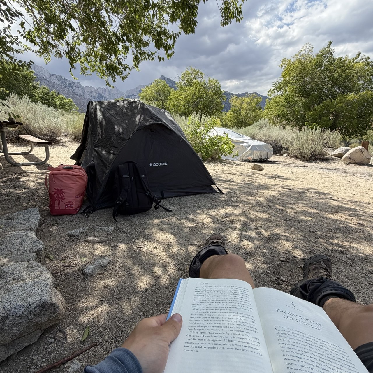
Where to sleep. Lone Pine Campground is the easy option: $34 a night, reservable on Recreation.gov, on the road up to Whitney Portal, ten minutes from the Alabama Hills. You don't have to pay for a site, though. The Alabama Hills are BLM land and you can camp for free — but only in the designated sites, which are signed with a tent symbol on a post, and since October 2024 you need a free permit (get it online at SierraForever.org or from the kiosks on Movie Road; it doesn't reserve you a spot, it just has to be in your car). If you want a bathroom and a picnic table but still don't want to pay much, Tuttle Creek Campground is BLM, first-come-first-served, and $12. That was my original plan — it was closed for road work the week I was there, which is a good reminder to check the BLM page before you drive out.
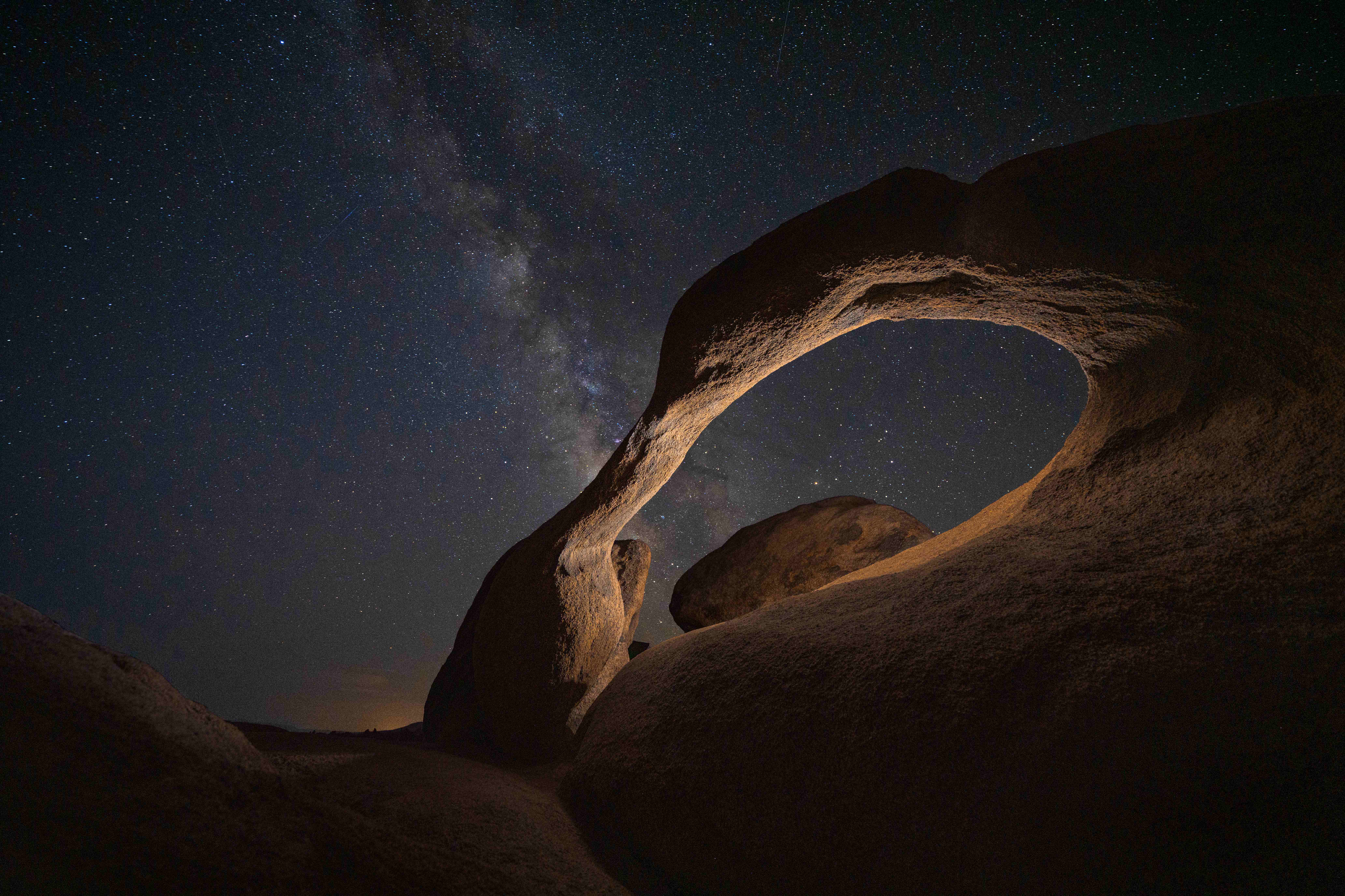
Mobius Arch. Around five in the evening I drove out Movie Road to the Arch Loop trailhead. There's a proper parking lot right at the trail, an information board, a vault toilet — and the arch itself is a few hundred yards of easy walking from the car. This matters more than it sounds if you're planning to shoot the arch at night, because it gets dark out here very fast, and walking back to the car in the black with a tripod over your shoulder is much nicer when it's a ten-minute stroll and not a mile of boulders. My car sits low to the ground and the road was fine that day; after rain, ask.
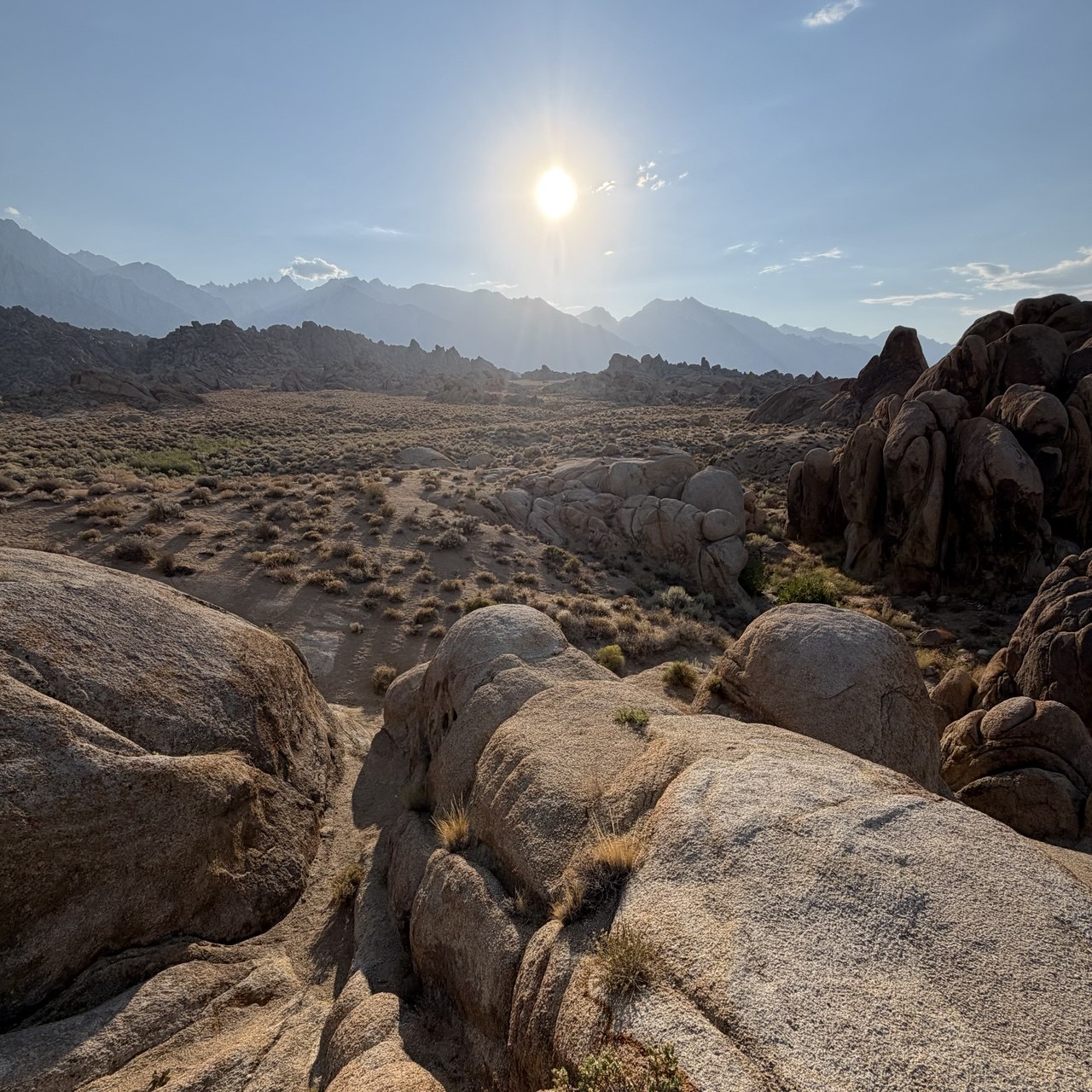
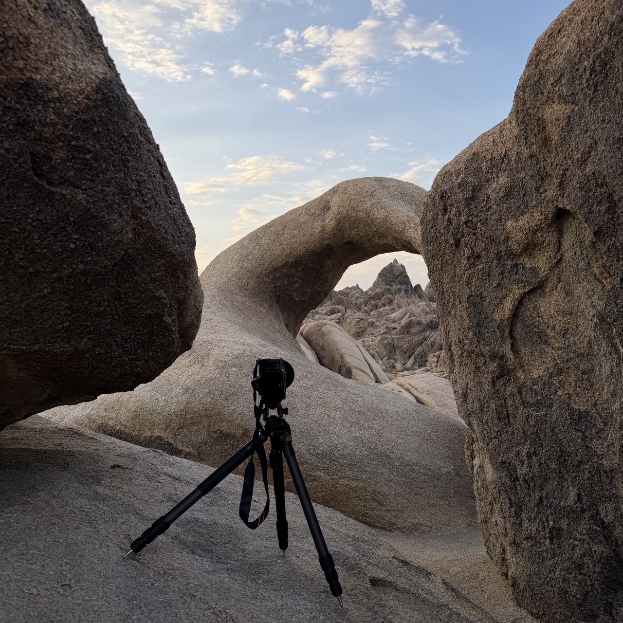
The classic frame here is Whitney through the arch at sunrise. I went the other way: I waited for the sky to go fully dark, set the tripod low under the arch, and then walked around behind it with a headlamp and the remote. One pass of light along the inside of the curve was all it needed. Light painting is easy to overdo — the goal was an arch that looked lit by something, not by me.
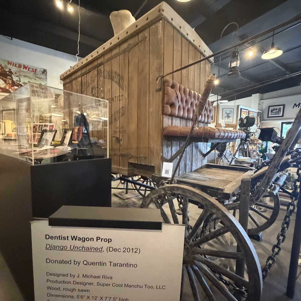
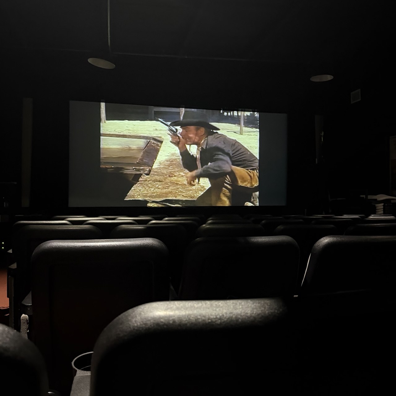
The museum. Before you leave town, go to the Museum of Western Film History on Main Street. Suggested donation is $8, it's open daily, and it is much bigger and much better than a small-town museum has any right to be — over 400 films were shot in the Alabama Hills and this is where the props and the posters ended up, from the silent era through Django Unchained and Iron Man. There's a small cinema inside where they run a documentary about the films made out here. Give it an hour; you'll want more.
The Ancient Bristlecone Pine Forest: Schulman Grove and Grandview Campground
From Big Pine, Highway 168 leaves 395 and climbs east into the White Mountains; White Mountain Road takes over and keeps climbing to Schulman Grove at just over 10,000 feet. The road is paved the whole way to the grove and its visitor center. Read that sentence again before you read the next section.
Grandview Campground sits at 8,600 feet, about five miles below the grove. It's first-come-first-served, no reservations, no water, vault toilets, and there's no fee — just a $20 donation box at the entrance, and nobody checking whether you used it. It's a big, quiet, high campground with the darkest sky of the trip, and I'd stay there again. But it's unpaved, the surface is sharp rock, and this is where my trip nearly ended.
The flat tire, and what the tow driver told me
The next morning I drove down toward Bishop and got a flat. Not a nail — the rear sidewall of the tire had a cut in it, almost certainly from the rocks in the campground.
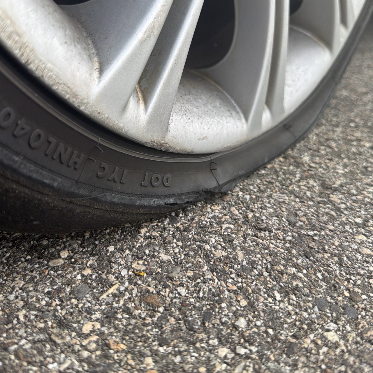
I waited about an hour for the tow truck, and in that hour three people stopped. One brought a tire repair kit and offered to sit with me until the truck came, because sitting alone on the highway is boring. One brought a big jack, on the theory that most people only carry the small one and he had something better. The third was a highway patrol officer who handed me water and food and stayed almost until the truck arrived — I hadn't asked him for any of it. It's a small thing, and it's stayed with me more than the tire has.
The tow driver, once he'd loaded my car on the flatbed, gave me the local version of the story. A lot of people drive past Schulman Grove onto the dirt road toward Patriarch Grove and come back with a busted tire. Tesla drivers, he said, are the reliable offenders — they overestimate what the car can do. And when it happens up there you have two options: drive the flat down the hill, or call for a tow. The second is very expensive, because AAA's winching rules typically require your car to be within about 25 feet of a passable paved road — off the road on dirt, you are on your own dime. He then drove me not to the tire shop I'd picked but to one he knew was cheaper. He was right; it was still not cheap.
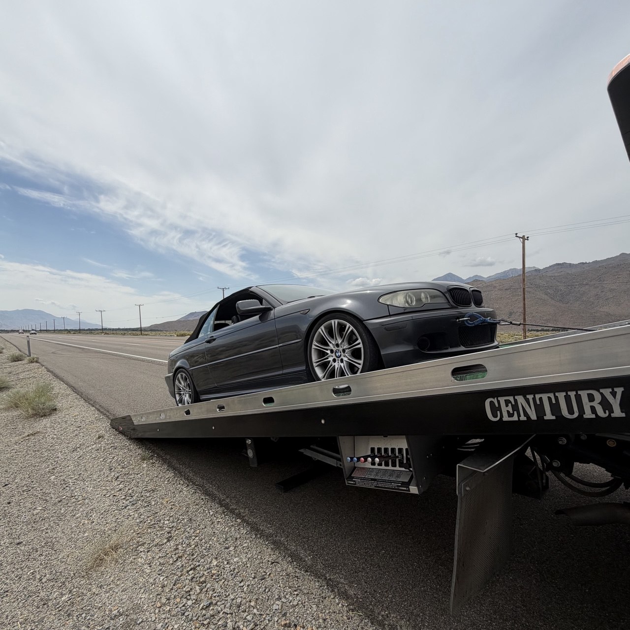
So: paved to Schulman Grove, and if you don't have a real four-wheel-drive with real tires, Schulman Grove is where you stop.
Schulman Grove
The grove itself is superb. The visitor center is new — the old one burned in 2008 — and the staff are exactly the kind of people you want running a place like this: patient, specific, happy to talk. There's an entrance fee — $6 when I was there (America the Beautiful passes work) and two trails from the parking lot: the Discovery Trail, a one-mile loop, and the Methuselah Trail, about four and a half miles, which passes the oldest known living tree without telling you which one it is. The grove is open 6am to 10pm. There's nobody there at night to enforce that, but the rule exists, and it's worth knowing before you plan to shoot the stars until two.
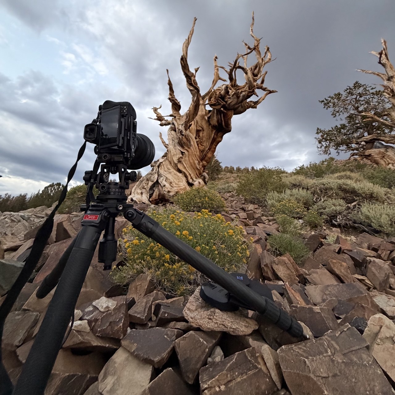
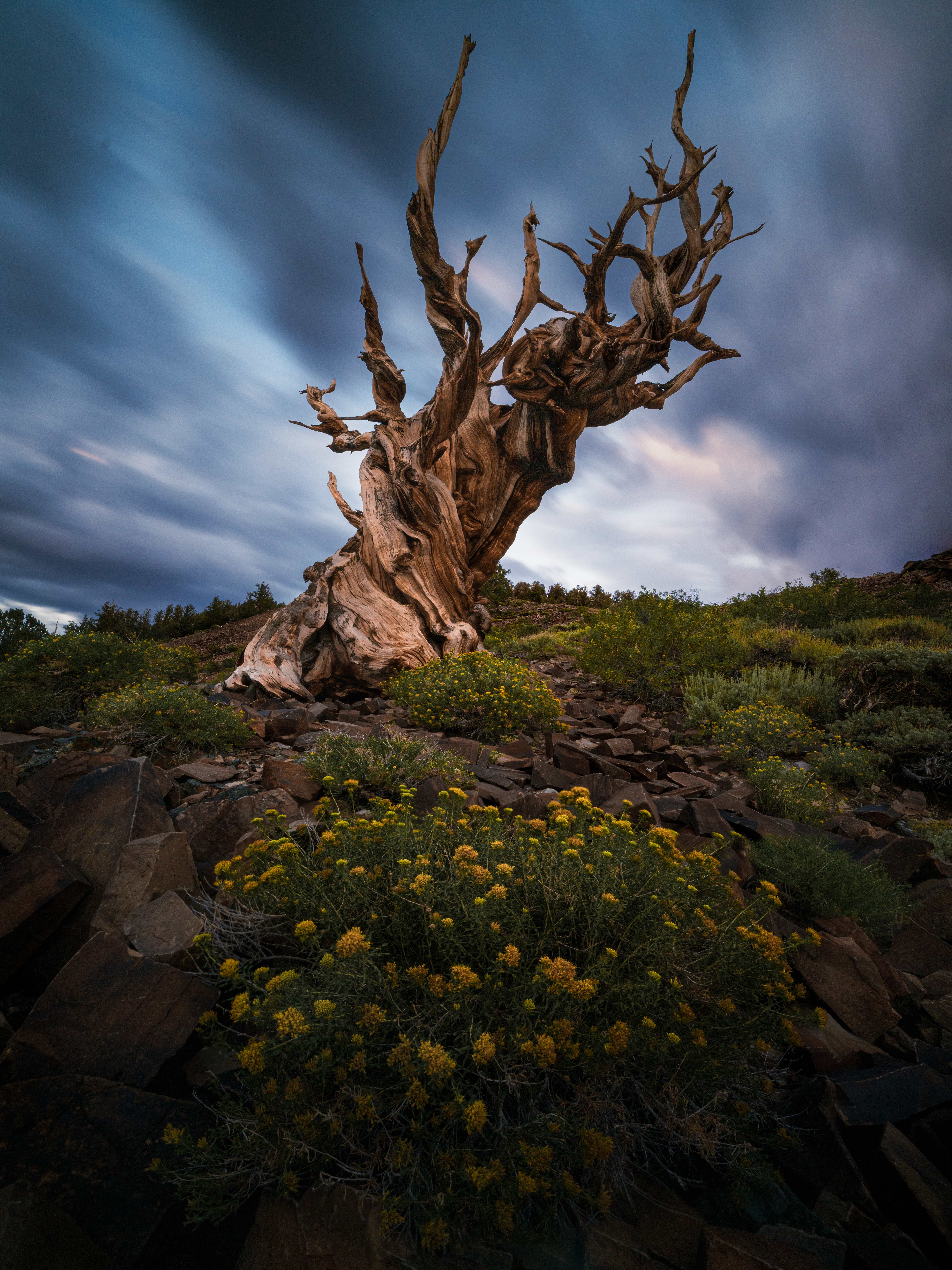
A tip for photographers: the tree in my frame — the one everyone photographs — is on the Discovery Trail, and the fastest way to it is to walk the loop clockwise — against the arrows, since the marked direction is counter-clockwise. You'll be there in ten minutes instead of forty.
I'd come for the Milky Way over that tree, like everyone else. The weather had other plans: cloud rolled over the range at dusk and the stars never showed. So it turned into a blue-hour frame with a bloom of yellow at the base for a bit of colour against all that dead wood — and honestly, I'm glad. It's the one bristlecone photograph I have that doesn't look like everyone else's.
Convict Lake: three nights, and a Milky Way shot that took five hours
Convict Lake is where I'd send anyone who asks where to base themselves on the northern half of this drive. The road is fully paved to the water. The campground is big (85 sites, $35, half reservable on Recreation.gov and half first-come), it's very close to the lake, and there's a roughly three-mile loop trail around the shore that's worth an hour whether or not you have a camera. The only complaint: the sites are exposed, and in August that means sun from the moment it clears Mount Morrison. Bring shade.
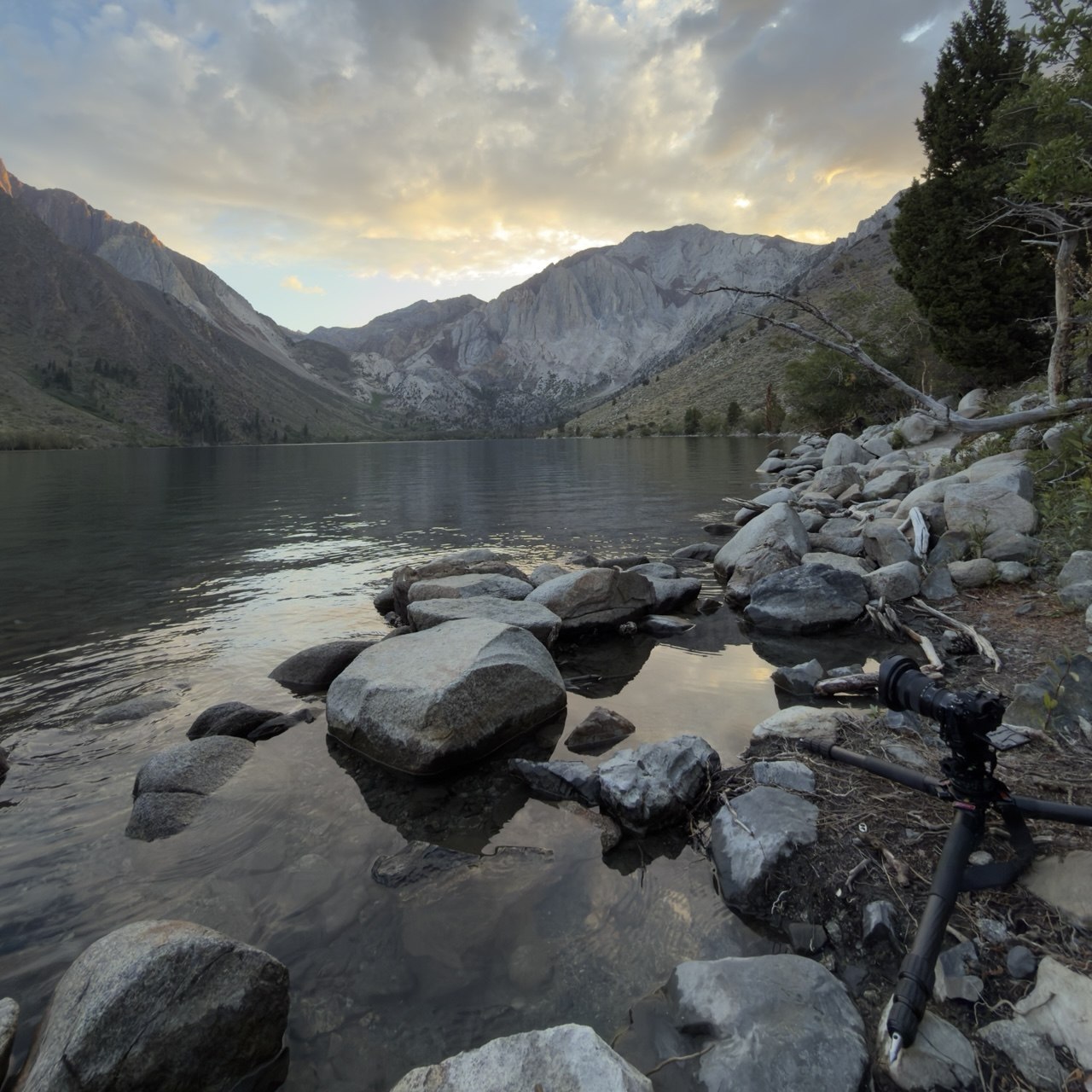
The first night I stayed on the shore from before sunset until about one in the morning — five hours for one photograph. Part of that was waiting for the Milky Way to swing round to where I wanted it over Mount Morrison. Part of it was scouting: walking the shoreline, trying compositions, watching what the light did as it went. The frame that came home is a time blend — a 900-second exposure to get enough light on the mountains, and a 20-second one for the sky so the stars stay points instead of trails. Neither works alone at midnight; the long one smears the sky, the short one leaves the mountains black.
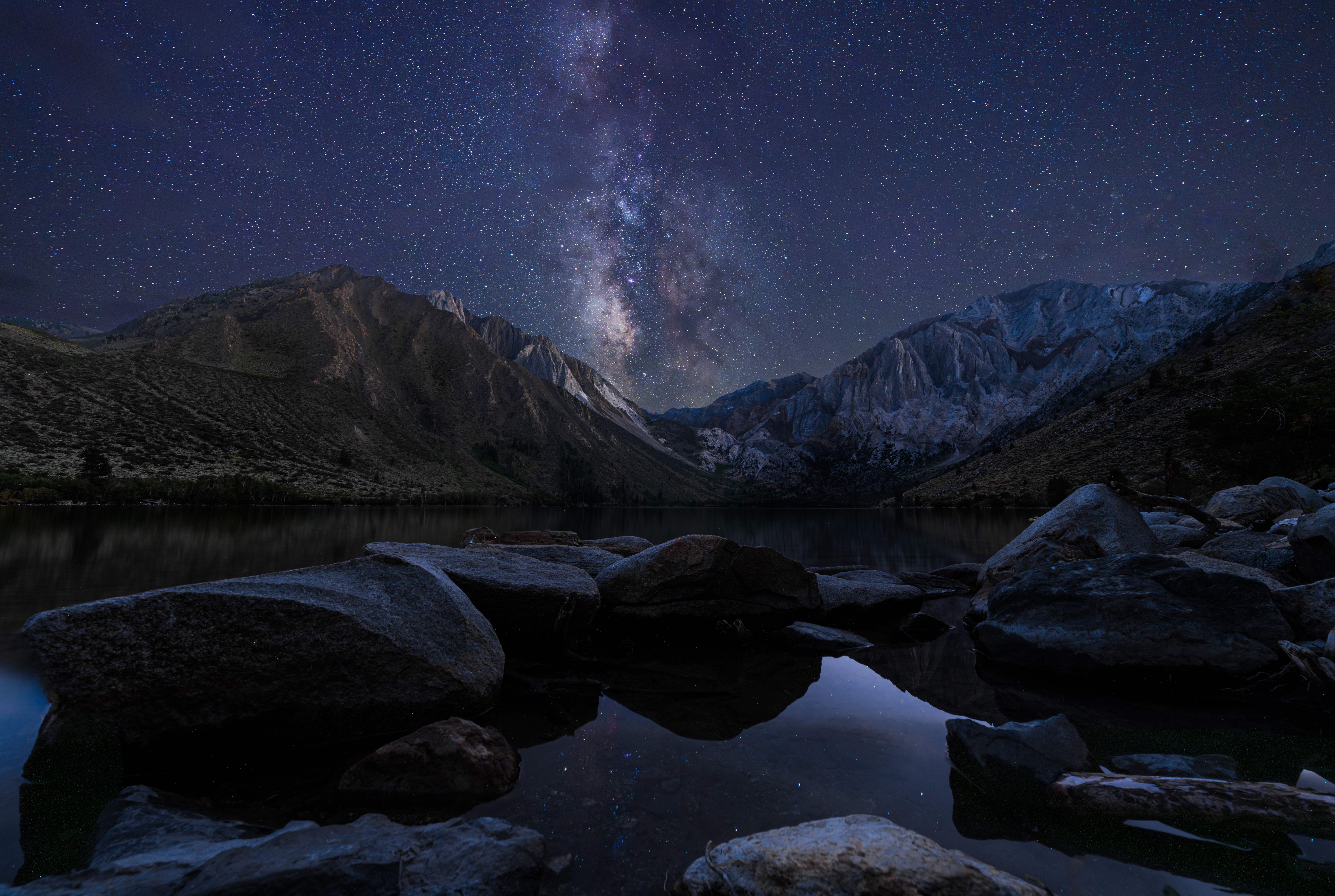
Here's the thing I most want to say about photographing in the mountains, and it applies to Convict Lake more than anywhere on this trip. PhotoPills, or whichever app you use, will give you a sunset time and a blue-hour window. In a place like this, those numbers are wrong. You are standing in a bowl of 12,000-foot peaks. The sun goes behind Laurel Mountain long before it sets, and the light in the basin changes on the mountains' schedule, not the horizon's.
So my advice — for the mountains and, honestly, for landscapes in general — is to arrive earlier than you think you need to and leave later than you think you need to. A lot of photographers either overestimate their ability to predict what the light will do, or they're a little lazy about it. When you give yourself the extra time, you can actually think about what you want, watch the place, and only then make a photograph that isn't the one Google showed you when you searched for the spot.
Hot Creek Geological Site at sunrise: be there before the air warms up
Fifteen minutes from the Convict Lake campground is Hot Creek Geological Site, a stretch of creek in a shallow gorge where boiling springs come up through the streambed. It's paved most of the way from 395, then a few miles of gravel to a parking lot with vault toilets right at the overlook. Swimming has been banned since 2006 — the springs geyser unpredictably — and the site is day-use, 6am to 10pm.
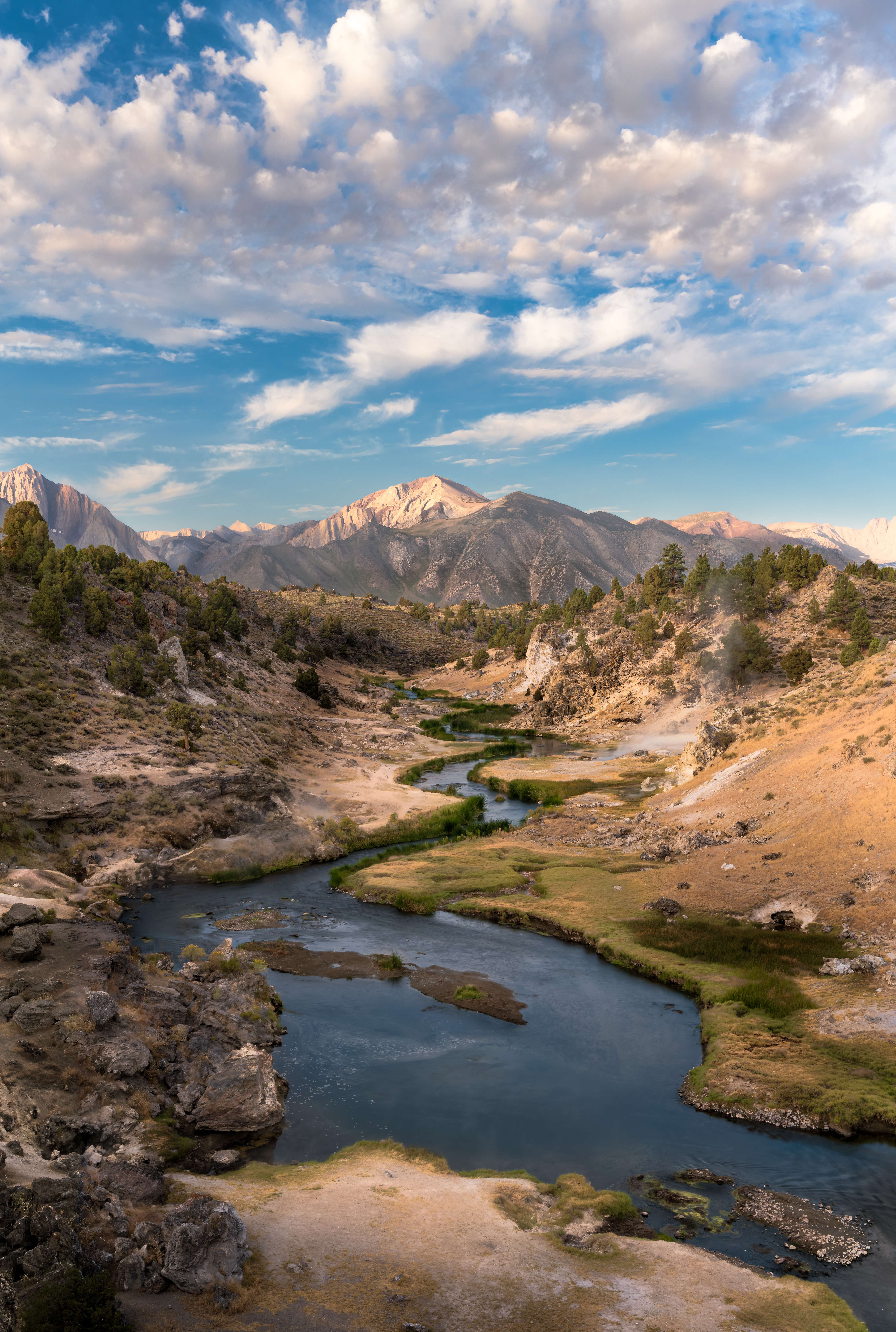
I finished the Convict Lake shot at 1am and was at Hot Creek at 5am, because for a photograph of a geothermal site there's really only one rule: be early. Steam is only visible while the air around the water is still colder than the water. Mid-August in this valley is warm even at dawn, so the steam was never going to be what it is on a January morning — I didn't get exactly what I wanted, and I'd go back in a colder month. What I did get was the vents smoking in the bends of the creek with first light on Mammoth Mountain behind them, which was the plan.
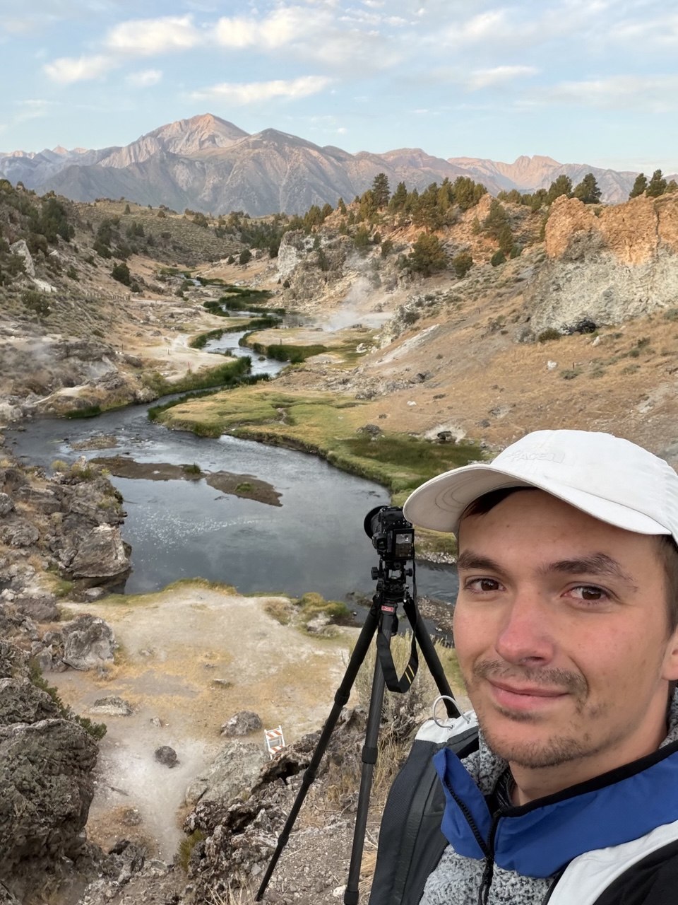
For a composition like this one you have to go a little past the parking lot: through the gate and along to the barbed-wire fence on the rim, which is where the creek lines up in front of the mountain. Then wait — the window is short. As soon as the sun's on the water, the steam thins to nothing.
Mono Lake and South Tufa: sunset, the Milky Way and the Perseids
Mono Lake is the reason to keep driving past Mammoth. It's a very old, very salty lake with tufa towers — limestone spires that formed underwater and were exposed when Los Angeles started diverting the streams — standing along the south shore. It looks like nowhere else in California.
Practical bits. South Tufa is the place to go: $3 per person for the day (interagency passes accepted), a boardwalk and a short trail to the shore, and in summer free ranger walks, usually daily at 10am and 6pm — check the current schedule and plan around one if you can, because the geology and the history of the water war are both better told standing on the shore than read off a sign. If you're lucky there's a volunteer at the trailhead who'll tell you about the birds. Lee Vining, five minutes north, has motels, gas, and food.
I went three times in two days, which is the advantage of camping 40 minutes away.
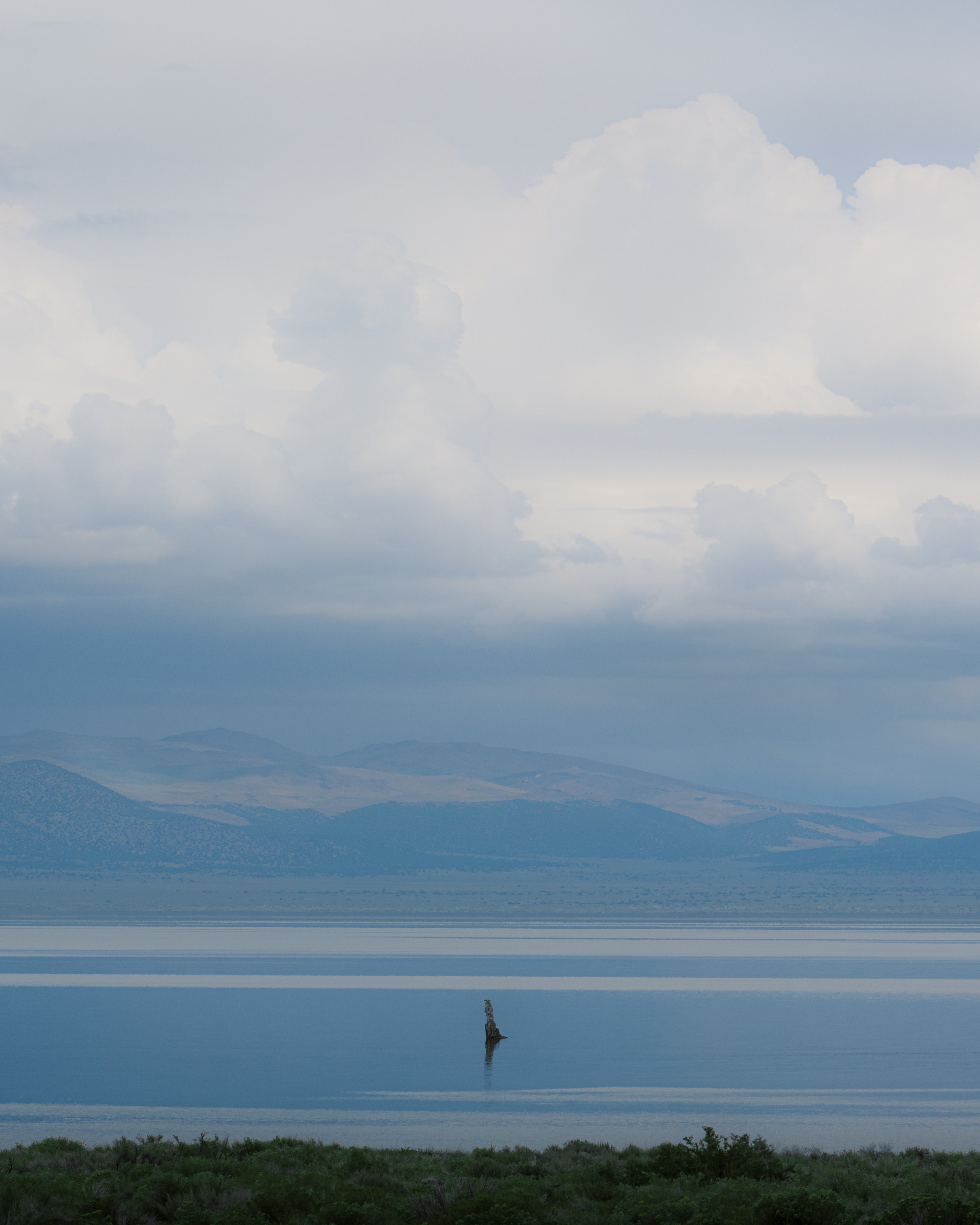
The first afternoon was for scouting. I walked the shore, looked at compositions for later, and made exactly one photograph — with a long lens, of a single tufa standing in the water while a storm built over the far shore. At 150mm the lake, the hills and the cloud deck stack into flat bands, and one tower gives the eye a place to land. The name was obvious the moment I saw it on the back of the camera.
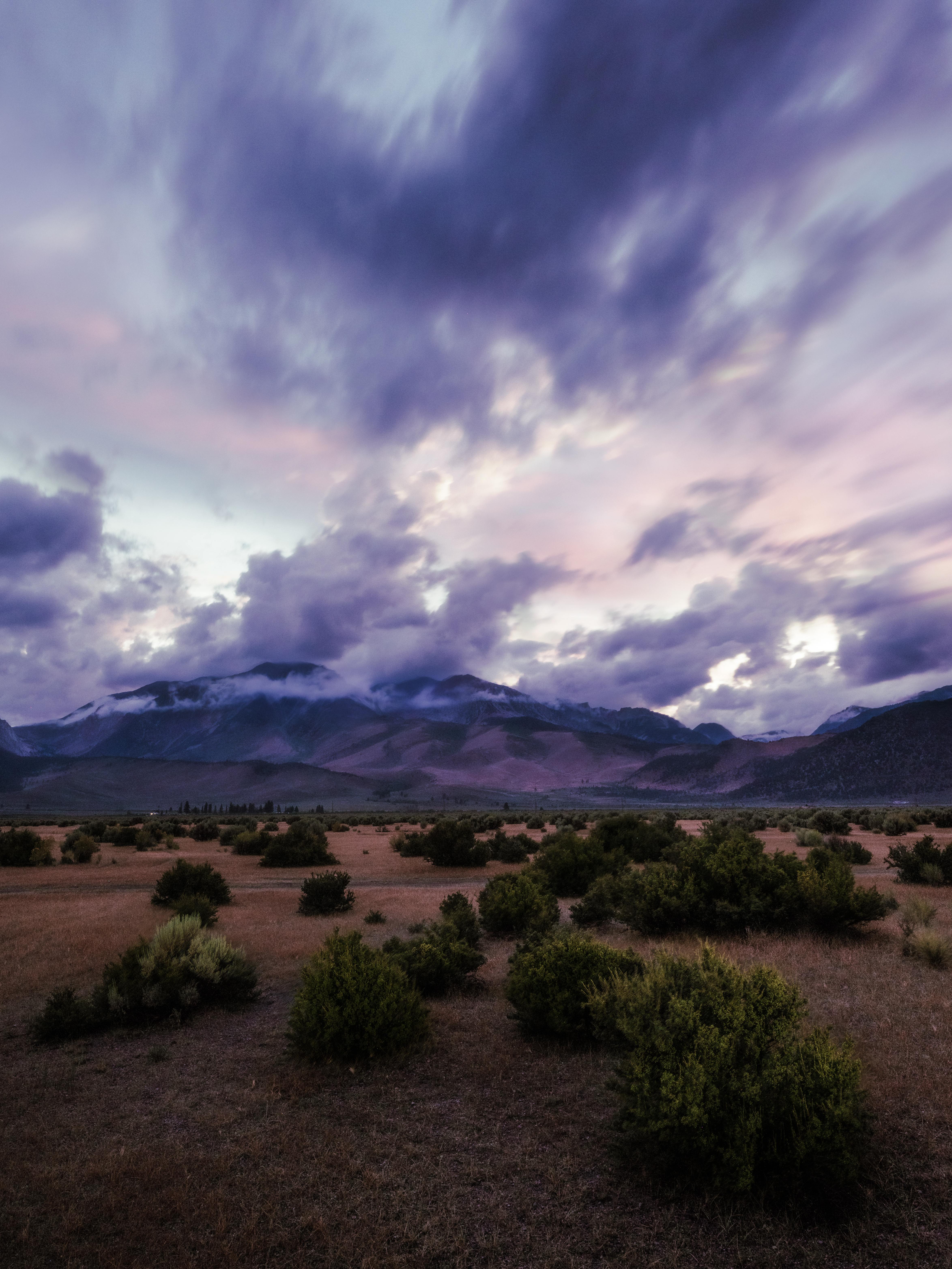
That evening it rained for hours. It was still warm on the ground, so the cloud sat very low and formed on the mountains — the kind of sky you only get when weather and temperature disagree. I was driving back toward the lake, saw what was happening near Williams Butte, and pulled off 395 and set up in the sagebrush.
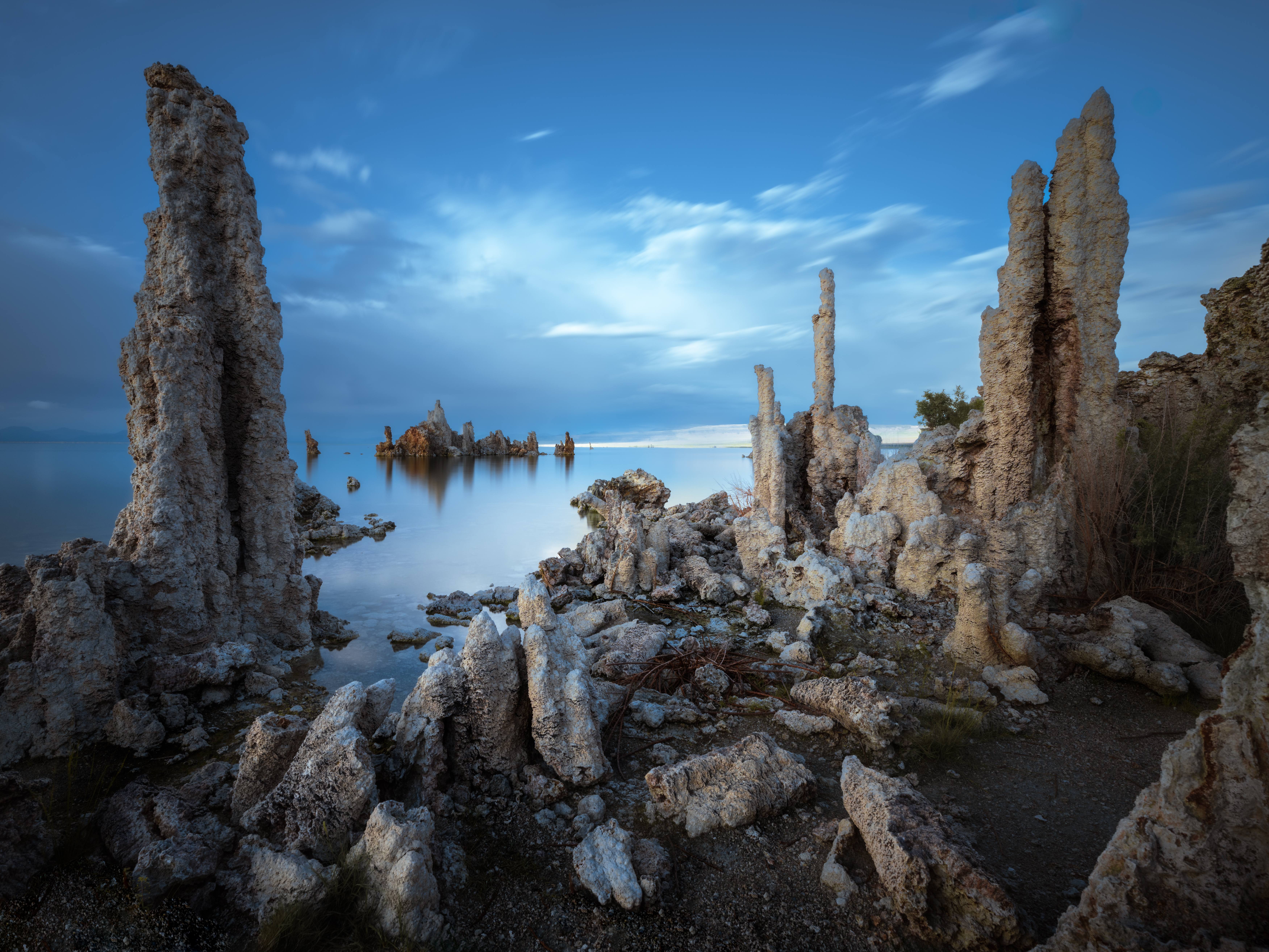
The last day it rained and hailed on and off from morning to afternoon. I waited it out at Convict Lake, reading and refreshing the radar, and when a window opened I drove to Mono for the last time. I got there early enough to walk the shore in flat light and make the quiet frame first — the towers standing in still water, nothing shouting.
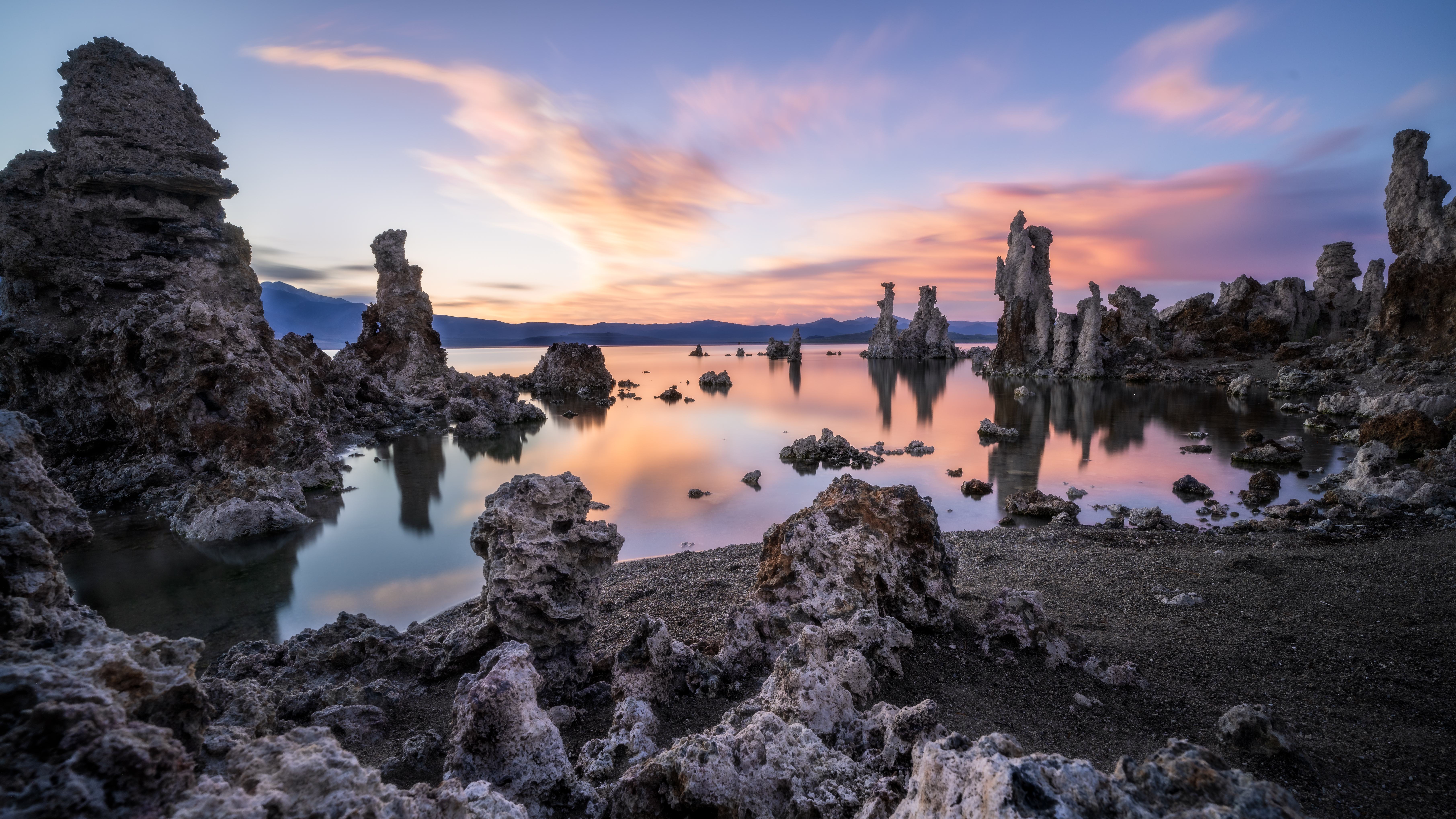
Then I set up for sunset. One thing to know about evenings at South Tufa: the Sierra crest takes the direct sun a good half hour before the app says it sets. The show isn't the sun going down — it's the afterglow on whatever cloud is over the lake to the east, and its reflection. Plan for that, not for a sunset.
After several days of rain the lake had come up noticeably, and there was water standing among tufa that usually sits on dry ground. That's the picture: I wedged the tripod under a tufa tower at the edge, aimed low at the horizon, and waited for the tail end of the storm to pull back and catch the light. When the cloud went pink and then red I was shooting continuously.
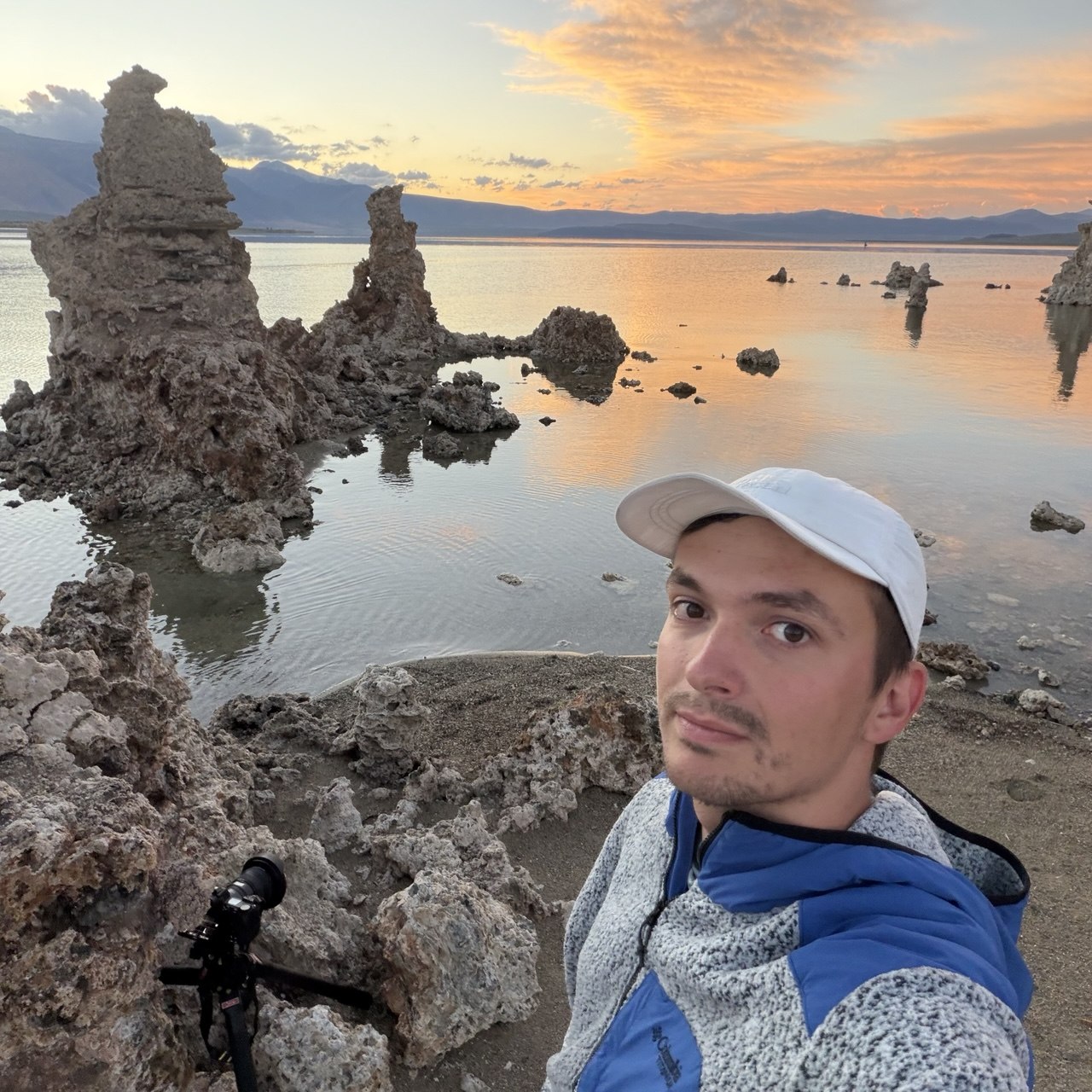
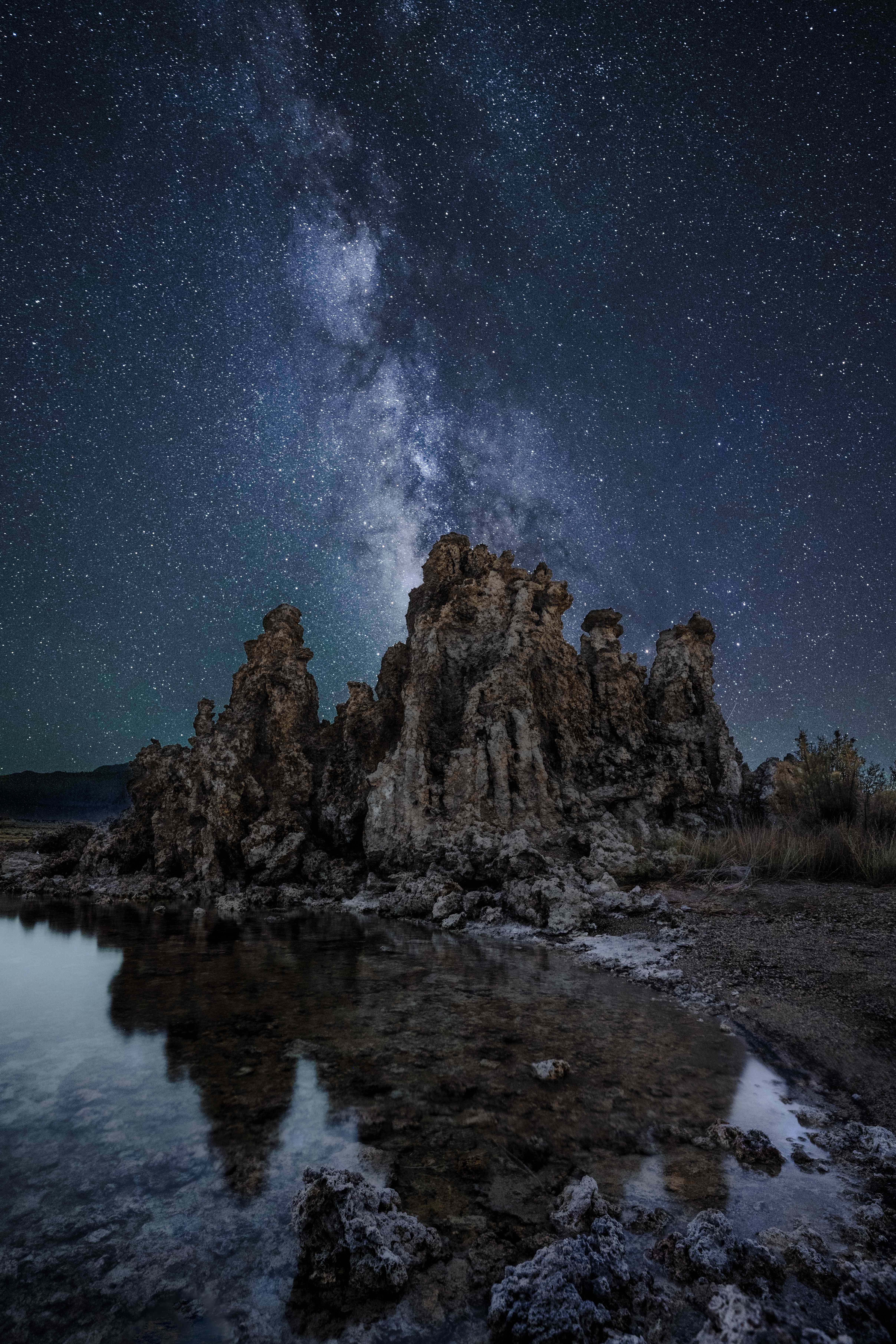
And then I stayed. It was the week of the Perseids — the peak was the 12th, but I'd seen meteors every night for three nights — and the moon was new, so the sky was properly black. Mono Lake sits in one of the darkest parts of the state, and over the next couple of hours I watched meteor after meteor come in and leave a tail across the whole sky. There were three or four other photographers on the shore that night, and we talked between exposures — every single day of this trip somebody with a tripod turned up and we ended up talking; it's a sociable hobby out here in a way it isn't in a city.
For the Milky Way shot I put the camera behind one of the big tufa formations with the tripod legs standing in the lake, because the reflection needed the lens at water level. It was too dark for one exposure to carry both halves — the tufa is a 480-second exposure and the sky a 20-second one, blended afterwards. Out of everything from that night, this is the one: the Milky Way pointing at the tufa, and the tufa in the water.
Weather, flexibility, and the tire: what the week actually taught me
Four of my five days had thunderstorms. One had hail.
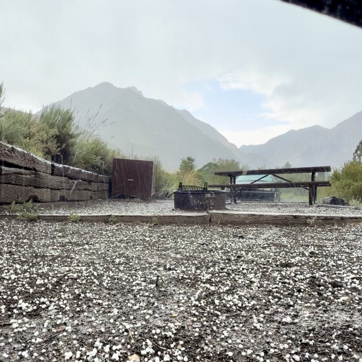
When I planned this trip the forecast said clear skies, no rain, and I planned accordingly: this shot at this place at this hour. When I got to the Alabama Hills the wind told me that plan was finished, and by the second day NOAA had a flood watch out for the area. That was the moment I understood the trip was going to need flexibility and a lot of improvising. Most mornings I left camp not knowing whether I'd be able to photograph anything at all — and most days the moody weather ended up being the reason the photograph works. Sometimes you have to take the risk to get the thing, and that's as true of photography as anything else.
Two things made the improvising possible. First, 395 is full of small towns. Every day the rhythm was: leave camp in the dark, make the photograph, drive to the nearest town for breakfast, then read and check the weather until the light started to matter again. Lone Pine, Big Pine, Bishop, Mammoth, Lee Vining — there's always a diner within half an hour, and plenty of motels if camping isn't your thing. Second, camping close to the places you want to shoot — Lone Pine for the Alabama Hills, Grandview for the bristlecones, Convict Lake for everything north of Bishop — meant I could go back when the light was better instead of settling for what I got the first time. That's the whole argument for three nights at Convict.
And the tire. Grandview is a fine campground and I'd stay there again — but with better tires than the ones I arrived on, and I'd drive it slower. If your car is low or your tires are ordinary, camp in Bishop and day-trip up to the grove on the pavement.
Camping along Highway 395 between Lone Pine and Mono Lake
| Campground | Fee | Reservable? | Elevation | Notes |
|---|---|---|---|---|
| Lone Pine Campground (USFS) | $34 | Yes, Recreation.gov (some FCFS) | 5,800 ft | On Whitney Portal Rd. Water, tables, toilets. 10 min to Alabama Hills. |
| Alabama Hills designated sites (BLM) | Free | No — free permit required | ~4,500 ft | Signed sites only (tent symbol on a post). No water, no toilets. Best for sunrise at Mobius. |
| Tuttle Creek (BLM) | $12 | No, FCFS | ~5,100 ft | Toilets, tables. Closed for road work Aug 9–15, 2026 — check first. |
| Grandview (USFS) | $20 donation (optional) | No, FCFS | 8,600 ft | No water. Rough gravel — sharp rock, see above. Darkest sky of the trip. 5 mi below Schulman Grove. |
| Convict Lake (USFS) | $35 | Yes, Recreation.gov (half FCFS) | 7,600 ft | Paved, bear boxes, water, exposed to sun. My base for three nights. |
One more thing on camping: fire restrictions were in effect across the Inyo National Forest while I was there, as they usually are by August. Check before you plan an evening around a campfire — and bring a real stove.
Photography tips for Highway 395 and the Eastern Sierra
Camp where the light will be, not where's convenient. The three campgrounds above are each ten minutes from a sunrise or a night sky. That's why I chose them.
Arrive earlier and leave later than the app says. In the mountains the timing is set by the ridge you're standing under, not the horizon. Extra time is what turns a copy of the shot you've seen into your own.
Steam wants cold air. Hot Creek at 5am in August is already marginal; the same frame in a cold month is a different photograph. Same logic for fog on Mono Lake.
Weather is not the enemy. Every frame in this post except the arch was made under a sky the forecast said wouldn't exist. Clear skies are the boring outcome.
Watch the water level. Mono Lake after several days of rain gave me reflections that aren't normally there. If it's been raining, go and look.
Time-blend for astro in the mountains. Convict Lake and South Tufa are both a long exposure for the ground and a short one for the sky. A tripod that doesn't move between them is the whole technique.
Respect the dirt. Paved to Schulman Grove; paved to Convict Lake; mostly paved to Hot Creek and Mobius Arch. If a road isn't paved and your car isn't built for it, that's information, not a challenge — I have the tire receipt to prove it.
Questions people ask about a Highway 395 road trip
Can you do Highway 395 in two days? Lone Pine to Mono Lake, yes — comfortably, with a night in between. Do the Alabama Hills at sunrise on day one and Mono Lake at sunset on day two and you'll have seen the best of it. The whole highway from LA to Tahoe with everything on it wants a week; this stretch doesn't.
Which direction is better? I drove it northbound so that I ended at Mono Lake, which is where I most wanted to spend an evening. Southbound puts Whitney and the Alabama Hills at the end, which is a fine finale too. Either way, plan the sunrises and sunsets first and the driving around them.
Is the Bristlecone Pine Forest worth the detour? Yes, if you have two days; it's the oldest living forest on earth and the drive up is spectacular. Skip it if you have one day — it's an hour up and an hour down from Bishop. Stop at Schulman Grove; the dirt road beyond it is for real 4WD.
Where can you camp for free along 395? The Alabama Hills' designated BLM sites (free permit needed) and Grandview Campground ($20 optional donation) are the two I used. Tuttle Creek is nearly free at $12.
Do you need a permit for the Alabama Hills? For camping, yes — a free one, since October 2024, from SierraForever.org or the Movie Road kiosks. Day visits and photography need nothing.
Can you swim at Hot Creek? No, since 2006. It geysers. Look, photograph, don't touch.
Is Mono Lake better at sunrise or sunset? I shot it at sunset both evenings and stayed for dark, and I'd do the same again — the afterglow over the lake and the reflection are the picture, and after that you get the sky. Sunrise puts direct light on the tufa from across the water; I haven't shot it yet, and I'd like to.
Where's the best sunrise and sunset? Sunrise: Mobius Arch, with the crest lighting up behind Whitney. Sunset: South Tufa on Mono Lake. If you only get one of each on this drive, those are the two.
I drove home on August 14th with a new tire, a memory card I was very careful with, and a week's worth of proof that the Eastern Sierra is at its best when the forecast is at its worst. The full set — the arch, the bristlecone, the two nights of Milky Way, the two evenings on Mono Lake — is in the landscapes gallery.